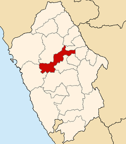
Province in Ancash, Peru
Yungay |
|---|
|
 |
 Flag  Coat of arms |
 |
| Country | Peru |
|---|
| Region | Ancash |
|---|
| Founded | October 28, 1904 |
|---|
| Capital | Yungay |
|---|
|
| • Mayor | Fernando Ciro Casio Consolación
(2019-2022) |
|---|
|
| • Total | 1,361.48 km2 (525.67 sq mi) |
|---|
| Elevation | 2,458 m (8,064 ft) |
|---|
|
| • Total | 50,841 |
|---|
| • Density | 37/km2 (97/sq mi) |
|---|
| UBIGEO | 0220 |
|---|
| Website | www.yungayperu.com.pe |
|---|
The Yungay Province is one of twenty provinces of the Ancash Region in Peru.[1]
Geography
The Cordillera Blanca and the Cordillera Negra traverse the province. Waskaran, the highest elevation of Peru, lies on the border to the Carhuaz Province. Chakrarahu, Chopicalqui, Tullparahu and Yanarahu (Ruriqucha) belong to the highest peaks of the province. Other mountains are listed below:[2]
Political division
Yungay is divided into eight districts, which are:
Ethnic groups
The people in the province are mainly indigenous citizens of Quechua descent. Quechua is the language which the majority of the population (73.19%) learnt to speak in childhood, 26.48 % of the residents started speaking using the Spanish language (2007 Peru Census).[3]
See also
References
External links
(in Spanish) www.yungayperu.com.pe
9°08′22″S 77°44′42″W / 9.13944°S 77.74500°W / -9.13944; -77.74500


