|
Ward Township, Pennsylvania
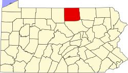
Ward Township is a township in Tioga County, Pennsylvania, United States. The population was 223 at the 2020 census.[2] It is the only township in Tioga County that is not in Pennsylvania's 5th congressional district, instead being located in the 10th. GeographyAccording to the United States Census Bureau, the township has a total area of 34.2 square miles (88.6 km2), of which 34.2 square miles (88.6 km2) is land and 0.03% is water. Ward Township is bordered by Sullivan Township to the north, Bradford County to the east, Union Township, to the south and Hamilton and Covington Townships to the west. DemographicsAs of the census[4] of 2000, there were 128 people, 60 households, and 36 families residing in the township. The population density was 3.7 people per square mile (1.4/km2). There were 220 housing units at an average density of 6.4/sq mi (2.5/km2). The racial makeup of the township was 100.00% White. There were 60 households, out of which 16.7% had children under the age of 18 living with them, 55.0% were married couples living together, and 40.0% were non-families. 33.3% of all households were made up of individuals, and 16.7% had someone living alone who was 65 years of age or older. The average household size was 2.13 and the average family size was 2.61. In the township the population was spread out, with 18.8% under the age of 18, 2.3% from 18 to 24, 25.0% from 25 to 44, 32.0% from 45 to 64, and 21.9% who were 65 years of age or older. The median age was 48 years. For every 100 females, there were 106.5 males. For every 100 females age 18 and over, there were 121.3 males. The median income for a household in the township was $27,500, and the median income for a family was $36,750. Males had a median income of $29,643 versus $18,958 for females. The per capita income for the township was $15,553. There were 12.2% of families and 15.6% of the population living below the poverty line, including no under eighteens and 33.3% of those over 64. Communities and locations
References
|
||||||||||||||||||||||||||||||||||||||||||||||||||||||||||||||||


