Waipara River (Canterbury)

Waipara River
Map
Location
CountryNew Zealand
RegionCanterbury
DistrictHurunui
Physical characteristics
Mouth 
 • location
Pegasus Bay
 • coordinates
43°09′06″S 172°47′59″E / 43.1516°S 172.7998°E / -43.1516; 172.7998
Length40 kilometres (25 mi)
Basin size726 square kilometres (280 sq mi)

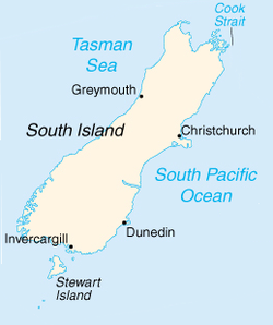
The Waipara River is a river in Canterbury in the South Island of New Zealand.[1] The river is about 40 kilometres (25 mi) long, and its catchment area is 726 square kilometres (280 sq mi).[2]

The river passes through the small town of Waipara on its 45-kilometre (28 mi) southeastward journey to the Pacific Ocean at the northern end of Pegasus Bay near Amberley.

See also

References

  1. ^ "Place name detail: Waipara River (Canterbury)". New Zealand Gazetteer. New Zealand Geographic Board. Retrieved 18 May 2020.
  2. ^ Introduction – Waipara Environment Canterbury Archived 2 April 2015 at the Wayback Machine