|
User talk:25or6to4/Archive 2TUSC token b837faf9a5e996eba55f794ee02979a9I am now proud owner of a TUSC account!
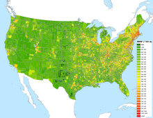
Disambiguation link notification for January 19Hi. Thank you for your recent edits. Wikipedia appreciates your help. We noticed though that when you edited National Register of Historic Places listings in Floyd County, Indiana, you added a link pointing to the disambiguation page Georgetown, Indiana (check to confirm | fix with Dab solver). Such links are almost always unintended, since a disambiguation page is merely a list of "Did you mean..." article titles. Read the FAQ • Join us at the DPL WikiProject. It's OK to remove this message. Also, to stop receiving these messages, follow these opt-out instructions. Thanks, DPL bot (talk) 11:17, 19 January 2013 (UTC) Hello! As a past participant in the U.S. portion of the USRD Cup, you may be interested to know that we are doing it again this year! Signups are at the above page and the contest will begin February 1. --Rschen7754 10:09, 24 January 2013 (UTC) National Register Information System at AFDBecause the nominator of Wikipedia:Articles for deletion/National Register Information System and the page's creator have just been interaction-banned, I've closed this discussion. Because it's not fair to participants like you to force you to start all over again, I've reopened it at Wikipedia:Articles for deletion/National Register Information System (2nd nomination), and I've copied your comments over there. Feel free to participate further over there. Nyttend (talk) 13:24, 12 March 2013 (UTC) your mapping skill and NRHP fully articled / fully illustrated status Hi 25or6to4, I wonder if you could consider discussion at Wikipedia talk:WikiProject National Register of Historic Places#Fully articled lists and contribute. I'd be really interested in seeing more prominence to your past map, and more use of that in leading the NRHP wikiproject as being, essentially, a map identifying/ranking areas by importance for development. (Though maybe color coding could be changed to better reflect that, i.e. a single color going from lightest to darkest shade? While currently the eye is drawn to very dark green counties where in fact those are the least important to address.) I'd like to see it matched by parallel maps reporting NRHP wikiproject progress in articling and in illustrating. Maybe you could help further? (Although also please see Dudemanfellabra's comment at User talk:Doncram#Fully articled lists, regarding his making progress towards making maps with county-specific detail maps at the U.S. or state levels (with some work-in-progress at User:Dudemanfellabra/Sandbox). Maybe he and you can coordinate.) Your great work with that nationwide map, having such great detail, should be more fully appreciated, IMO. I always enjoy it leading off the WikiProject NRHP mainpage, at least. cheers, --doncram 14:57, 27 March 2013 (UTC) The Center Line: Spring 2013
I-75 mapCan you indicate the base GIS data you used to create File:I-75 (MI) map.svg, which is in use on Interstate 75 in Michigan, an article at FAC? A question about this has come up at the FAC. Thanks! Imzadi 1979 → 17:21, 26 July 2013 (UTC) July 2013
Thanks, BracketBot (talk) 14:18, 31 July 2013 (UTC) The Center Line: Summer 2013
LatLon VerificationsI noticed that you did the edit on the Harris County Historic Places to clean up the latlon data. Is there a publicly available data set of Historical places - the best I've found is on the here at Wikipedia, but with errors like the latlon that you've corrected, I don't feel like I can trust the data. Thanks! --Isaiah (talk) 22:13, 13 September 2013 (UTC) Illinois locator mapNobody's responded so far at WP:GLM regarding the Illinois locator map. Have you heard anything from anyone via any other medium? Nyttend (talk) 01:40, 30 September 2013 (UTC)
Books and Bytes: The Wikipedia Library NewsletterBooks and Bytes
Volume 1, Issue 1, October 2013 Greetings Wikipedia Library members! Welcome to the inaugural edition of Books and Bytes, TWL’s monthly newsletter. We're sending you the first edition of this opt-in newsletter, because you signed up, or applied for a free research account: HighBeam, Credo, Questia, JSTOR, or Cochrane. To receive future updates of Books and Bytes, please add your name to the subscriber's list. There's lots of news this month for the Wikipedia Library, including new accounts, upcoming events, and new ways to get involved... New positions: Sign up to be a Wikipedia Visiting Scholar, or a Volunteer Wikipedia Librarian Wikipedia Loves Libraries: Off to a roaring start this fall in the United States: 29 events are planned or have been hosted. New subscription donations: Cochrane round 2; HighBeam round 8; Questia round 4... Can we partner with NY Times and Lexis-Nexis?? New ideas: OCLC innovations in the works; VisualEditor Reference Dialog Workshop; a photo contest idea emerges News from the library world: Wikipedian joins the National Archives full time; the Getty Museum releases 4,500 images; CERN goes CC-BY Announcing WikiProject Open: WikiProject Open kicked off in October, with several brainstorming and co-working sessions New ways to get involved: Visiting scholar requirements; subject guides; room for library expansion and exploration Thanks for reading! All future newsletters will be opt-in only. Have an item for the next issue? Leave a note for the editor on the Suggestions page. --The Interior 20:27, 27 October 2013 (UTC) The Center Line: Fall 2013
|
||||||||||||||||||||||||||||||||||||||

