|
Umzinto
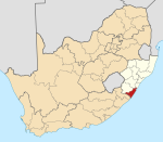
Umzinto is a town, located in the South Coast of KwaZulu-Natal, South Africa, approximately 67 kilometres (42 mi) south-west of Durban. It was a sugarcane growing area and the town was set up as the centre for a sugar mill. Although Umzinto has historically been predominantly populated by Indians, it has become a melting pot of cultures and races with a significant number of Black and Coloured residents residing here too. Etymology"Umzinto" is said to be derived from the Zulu "umenzi wezinto", meaning "the kraal [or place] of accomplishment".[2] According to an urban legend, the town's name derived from a visit by two men, one of whom was named Um. On encountering a stream, the men decided to cross it, but Um did not notice the crocodile lurking beneath the surface.[3] Subsequently, Um was attacked by the crocodile, and bitten in half. "Um's in two!" his friend exclaimed. The legend has been ascribed to Jonathan Swift[4] but Swift died in 1745, decades before the British encountered the region. HistoryThe first public company in Natal was established at Umzinto on the 6 July 1846. The sugar cane fields on the outskirts of Umzinto are owned and run by Crookes Brothers, a JSE listed company. Umzinto was named the last town in Durban in 1963. GeographyUmzinto lies just inland from the coastal village of Park Rynie, in hilly countryside and to the north of the uMzinto River, after which it is named. The nearest settlements to Umzinto include Park Rynie (8 km), Amandawe (10 km), Scottburgh (12 km), Pennington (16 km) and Amahlongwa (16 km). EconomyToday, Umzinto has become a small yet bustling town that serves as a service centre to the surrounding rural communities. Typical of many small South African towns, Umzinto has a singular main road, Nelson Mandela Road, that forms the backbone of the town lined by a number of national and local retailers and businesses. Umzinto was once the home of three large textile mills, namely Alitex, Bally Spinning Mills and MYM Textiles that used to export abroad. Today only one survives and is not as productive as it used to be. Consequently, this has affected the economy of Umzinto negatively.[citation needed] SportUmzinto hosted two class-A cricket matches at the Alexandra Memorial Ground, one on 2 March 1974, when Natal B hosted Griqualand West in the Currie Cup Section B, and again on 19 March 1977, when Natal B faced Border in the same contest.[citation needed] Law and governmentThe municipality has not maintained the roads and currently the roads are in a deplorable condition.[according to whom?] In 1995, low cost housing was developed on the outskirts called Gandhi Nagar.[citation needed] EducationSchools: Umzintovale Primary School, Umzinto Secondary School, Umzinto Islamic School, St Patrick's Primary School, Roseville Secondary School, St Annes Primary School Umzinto also houses a Darul-Uloom called Madrassa Da'watul Haq that has produced many graduates who have memorised the entire Quraan.[citation needed] Halls: Sanathan Hall, Islamic Cultural Centre, Umzinto Town Hall MediaRadio Station : Life FM KZN InfrastructureRailwaysUntil halfway through the 1980s, Umzinto was the southern terminus of the Umzinto - Donnybrook narrow gauge railway and had transshipment facilities to a Cape gauge branch line to Kelso, along the railway to Johannesburg RoadNelson Mandela Road (P197-3) is the north–south main road connecting Umzinto with Esperanza and Amandawe that passes through the Umzinto CBD and provides access to the R612, while the R612 is an east–west regional route connecting Park Rynie with Ixopo that by-passes Umzinto to the south and provides access to the N2 freeway (to Durban and Port Shepstone) by-passing Umzinto to the east. Umzinto can also be accessed by turning off the R612 onto Park Rynie Road from the south-east. Notable residents
References
|
||||||||||||||||||||||||||||||||||||||||||||||||||||||


