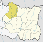
Village development committee in Sagarmatha Zone, Nepal
Tingla is a village development committee in Solukhumbu District in the Sagarmatha Zone of north-eastern Nepal. At the time of the 1991 Nepal census it had a population of 3,738 people living in 710 individual households.[1]
Climate
| Climate data for Tingla (Pakarnas), elevation 1,982 m (6,503 ft)
|
| Month
|
Jan
|
Feb
|
Mar
|
Apr
|
May
|
Jun
|
Jul
|
Aug
|
Sep
|
Oct
|
Nov
|
Dec
|
Year
|
| Mean daily maximum °C (°F)
|
13.2
(55.8)
|
14.8
(58.6)
|
19.0
(66.2)
|
22.5
(72.5)
|
23.3
(73.9)
|
23.4
(74.1)
|
22.7
(72.9)
|
22.8
(73.0)
|
21.9
(71.4)
|
21.0
(69.8)
|
17.8
(64.0)
|
14.6
(58.3)
|
19.8
(67.5)
|
| Mean daily minimum °C (°F)
|
1.1
(34.0)
|
2.4
(36.3)
|
6.0
(42.8)
|
9.6
(49.3)
|
12.2
(54.0)
|
14.9
(58.8)
|
15.5
(59.9)
|
15.0
(59.0)
|
14.0
(57.2)
|
10.7
(51.3)
|
5.3
(41.5)
|
2.0
(35.6)
|
9.1
(48.3)
|
| Average precipitation mm (inches)
|
15.8
(0.62)
|
16.2
(0.64)
|
32.2
(1.27)
|
45.7
(1.80)
|
92.2
(3.63)
|
263.6
(10.38)
|
493.2
(19.42)
|
484.4
(19.07)
|
253.4
(9.98)
|
70.4
(2.77)
|
9.6
(0.38)
|
8.3
(0.33)
|
1,785
(70.29)
|
| Source 1: Australian National University[2]
|
| Source 2: Japan International Cooperation Agency (precipitation)[3]
|
References
External links

