|
Thai Ban
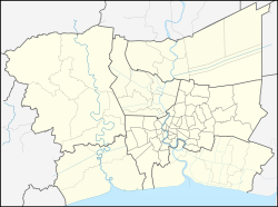
Thai Ban (Thai: ท้ายบ้าน, pronounced [tʰáːj bâːn]) is a tambon (sub-district) in Mueang Samut Prakan District, Samut Prakan Province. ToponymyIts name "Thai Ban" literally translates to "the end of the muban (village)". Because during the reign of King Chulalongkorn (Rama V), it was considered a very distant area from the downtown Samut Prakan, also colloquially known as Pak Nam. At that time it was called "Thai Ban Talat" (the end of the marketplace), later called "Thai Ban" for short.[2] GeographyAdjacent areas are, clockwise from north, Pak Nam, Thai Ban Mai, Bang Pu Mai, all of them are in its district, and Laem Fa Pha in Phra Samut Chedi District (across Chao Phraya River). It borders Bay of Bangkok (upper Gulf of Thailand) to the south.[3] AdministrationCentral administrationThe entire area is under the administration of Bang Pu Sub-District Municipality. Local administrationThai Ban is divided into seven administrative villages. PopulationAs of April 30, 2022, it had a total population of 24,350 people (11,866 males, 12,484 females) in 11,415 households.[1] Places
Neighbouring placesReferences
|
||||||||||||||||||||||||||||

