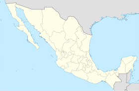
Municipality in Aguascalientes, Mexico
Tepezalá is a municipality and town in the Mexican state of Aguascalientes . The town of Tepezalá serves as the municipal seat for the surrounding municipality of Tepezalá.
Tepezala is located on the foothills of the eastern mountains of the state, a land rich in minerals and arid in vegetation that was on the old Silver Route during the 16th century, which brought so much wealth to the region and help conquer the inhospitable north of Mexico. The town's mines made it famous and brought wealth to the state.
Demographics
Historical population Year 2010 19,668 — 2015 20,926 +6.4% 2020 22,485 +7.5% [ 3] [ 4] [ 5] [ 6]
As of the 2015 Mexican Intercensal Survey, Tepezalá municipality has a population of 20,926.[ 2] [ 7] San Antonio (3,345), classified as urban, and El Chayote (1,817), and Carboneras (1,261), classified as rural.[ 7]
Geography
Climate
Climate data for Tepezala (1951–2010)
Month
Jan
Feb
Mar
Apr
May
Jun
Jul
Aug
Sep
Oct
Nov
Dec
Year
Record high °C (°F)
31.0
31.5
33.0
37.0
37.0
37.0
35.5
34.0
36.0
32.5
31.0
35.0
37.0
Mean daily maximum °C (°F)
21.9
23.7
26.4
29.3
30.7
29.8
27.3
27.0
26.0
25.7
24.2
22.2
26.2
Daily mean °C (°F)
12.9
14.3
16.8
19.6
21.2
21.4
19.8
19.3
18.7
17.6
15.1
13.3
17.5
Mean daily minimum °C (°F)
3.8
5.0
7.2
9.9
11.8
12.9
12.2
11.6
11.4
9.5
6.0
4.5
8.8
Record low °C (°F)
−11.0
−2.0
−2.0
0.0
1.0
4.5
5.0
4.0
2.0
1.0
−2.0
−5.5
−11.0
Average precipitation mm (inches)
16.1
10.3
5.4
6.9
19.4
59.3
113.5
94.6
74.3
27.4
8.1
11.8
447.1
Average precipitation days (≥ 0.1 mm)
2.0
1.4
1.0
1.2
2.7
7.0
10.3
9.5
7.1
3.5
1.2
1.7
48.6
Source: Servicio Meteorologico Nacional[ 8] [ 9]
Gallery
Templo del Nuestra Señora del Refugio, fachada.
Templo de Nuestra Señora del Refugio, vista lateral.
Templo de Nuestra Señora del Refugio, interior.
Santuario del Señor de Tepezalá.
References
^ "Unidad de Microrregiones Cedulas de Informacion Municipal (SCIM)" (in Spanish). Secretara de Desarrollo Social. Archived from the original on December 31, 2017. Retrieved November 18, 2017 .^ a b "Tabulados de la Encuesta Intercensal 2015" (xls) (in Spanish). INEGI. Archived from the original on December 31, 2017. Retrieved July 15, 2017 .^ "Localidades y su población por municipio según tamaño de localidad" (PDF) (in Spanish). INEGI. Archived from the original (PDF) on August 31, 2018. Retrieved July 15, 2017 .^ "Número de habitantes" . INEGI (National Institute of Statistics and Geography). Archived from the original on July 2, 2017. Retrieved July 15, 2017 .^ "Tabulados de la Encuesta Intercensal 2015" (xls) (in Spanish). INEGI. Archived from the original on December 31, 2017. Retrieved July 15, 2017 .^ "INEGI. Censo de Población y Vivienda 2020. Tabulados del Cuestionario Básico – Aguascalientes" [INEGI. 2020 Population and Housing Census. Basic Questionnaire Tabulations – Aguascalientes] (Excel) (in Spanish). INEGI . 2020. pp. 1– 4. Archived from the original on January 28, 2021. Retrieved January 27, 2021 .^ a b "Tepezalá" . Catálogo de Localidades . Secretaría de Desarrollo Social (SEDESOL). Retrieved April 23, 2014 .^
"Estado de Aguascalientes-Estacion: Tepezala" . Normales Climatologicas 1951–2010 (in Spanish). Servicio Meteorologico Nacional. Retrieved May 8, 2015 .
^ "Extreme Temperatures and Precipitation for Tepezala 1962–2010" (in Spanish). Servicio Meteorológico Nacional. Retrieved May 8, 2015 .
External links


