Sutter Buttes

Sutter Buttes
Bird's eye view of the Sutter Buttes, rising over the town of Yuba City, California
Highest point
PeakSouth Butte
Elevation2,122 ft (647 m)
Prominence2,050 ft (625 m)
ListingCalifornia county high points 56th
Coordinates39°12′21″N 121°49′13″W / 39.2057239°N 121.8202495°W / 39.2057239; -121.8202495[1]
Geography
Sutter Buttes is located in California
Sutter Buttes
Sutter Buttes
Sutter Buttes is located in the United States
Sutter Buttes
Sutter Buttes
LocationSutter County, California, U.S.
RegionSacramento Valley
Topo mapUSGS Sutter Buttes
Geology
Type of rockvolcanic neck
Marysville Buttes (Sutter Buttes) Gas Field Geologic map
Marysville Buttes (Sutter Buttes) Gas Field Geologic Cross Section with 3x vertical exaggeration

The Sutter Buttes (Maidu: Histum Yani or Esto Yamani, Wintun: Olonai-Tol, Nisenan: Estom Yanim) are a small circular complex of eroded volcanic lava domes which rise as buttes above the flat plains of the Sacramento Valley in Sutter County, northern California. They are situated just outside Yuba City in the northern part of the state's Central Valley.

These remnants of a dormant volcano are colloquially referred to as the world's smallest mountain range.[2] The Sutter Buttes have as their highest point the summit of South Butte, at 2,122 ft (647 m), which is also the highest point in Sutter County.[3]

At the base of the mountain is the small town of Sutter. The town, county, and buttes are named for John Sutter, a man who received a large land grant in the area from the Mexican government.[4][5]

Geography

The volcanic remnants form a rough circle approximately 10 mi (16 km) from north to south and east to west.[4]

Geology

The Sutter Buttes lie within the Central Valley of California.[6]

They were formed about 1.6 million years ago in the early Pleistocene Epoch[6] by volcanic activity. They are the remnants of a volcano that has been dormant[7] for about 1.4 million years.[8] Some geological references suggest that the volcano represents the southernmost boundary of the Cascade Volcanoes, but there are significant differences in age and form compared to the other volcanoes in that range.[9] Others suggest that its age places it with the volcanic elements of the California Coast Ranges; its composition is closer to that range but does have significant differences.[10]

Exploration of natural gas leaks was first undertaken at South Butte by Dexter Cook in 1864, when he dug a 65 ft (20 m) shaft.[8] Sutter Buttes Oil Company drilled a well in 1927 to a depth of 2,900 ft (880 m), and other wells were drilled on the western margin. Buttes Oilfields, Inc., drilled a well in 1932, but it wasn't until June 1935, though, that it drilled the first of four gas wells in the area of T. 15 N., R 1 E.[11]

Soils and vegetation

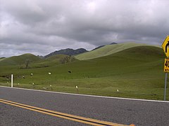
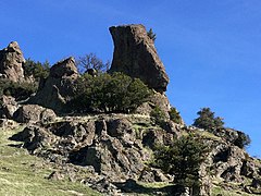
The rugged central part of the Buttes has a stony, brown sandy loam of variable depth and good-to-somewhat-excessive drainage. The smoother perimeter has more variable soil, with clay or silt loam areas among the sandy loams. These soils support grassland or oak woodland.[12] The Sutter Buttes contain many species of flora and fauna. Wildflowers are represented by numerous taxa; included in these many wildflowers is the yellow mariposa lily, Calochortus luteus.[13]

History

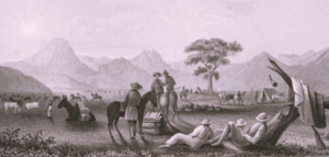
Sutter Buttes Terrain
Sutter Buttes Terrain in 1841

Indigenous era

The Sutter Buttes figure prominently in the creation stories and other traditions of the indigenous Nisenan, Maidu, and Wintun peoples. The Nisenan lived on the East side of the Buttes, while the Patwin Wintun lived on the West side. The Nisenan name for the Buttes is Estom Yanim.[14] The Maidu name for the Sutter Buttes is Histum Yani (middle mountains of the Valley) or Esto Yamani,[15] while the Wintun name for the Sutter Buttes is Onolai-Tol.[16] All of these names roughly mean "The Middle Mountains".

There were seasonal encampments in the Buttes, and all these tribes visited the Buttes regularly to gather acorns and other foods or to hunt game. The Buttes were also a center of regional Native American religion. According to anthropologist Alfred Kroeber, the Patwin village where the city of Colusa now stands was the “hotbed” where the Kuksu Cult was established. This religion spread through much of Northern California. Ceremonies were performed in earthen dance lodges where spirit impersonators would re-enact ancient mythological events.

In the Maidu and Nisenan religions, the Sutter Buttes is the place where dying people came to ascend to the afterlife.[10]

Spanish & Mexican periods

The Spaniard Gabriel Moraga was the first European to see the Sutter Buttes in 1806. In 1817, the Californio Luis Antonio Argüello named it "los tres picos"[17] (the three peaks, name that appears on the Mexican land grant made to Captain John Sutter). In 1843, John C. Frémont called them "The Three Buttes." James Dwight Dana explored the buttes on 16 Oct. 1841, while part of the United States Exploring Expedition.[8] In June 1846, John C. Frémont, on a massacre spree since April, stopped at the Sutter Buttes. Fearing an attack from the local Indians, Frémont led a preemptive attack which killed many Indians and led the others to flee the area. It remains known as the Sutter Buttes massacre.[18]

American period

Under the 1848 Treaty of Guadalupe Hildago at the end of the war with Mexico the United States acquired California. Under the treaty the United States agreed to respect titles conveyed by Mexico. John Sutter claimed ownership of the Sutter Buttes under his New Helvetia grant. The United States Land Commission and the courts determined that Sutter's New Helvetia Grant did not include the Buttes. No land title in the Buttes arises under a Spanish or Mexican Grant, all title to land in the Buttes derives from the federal government.[19][20][full citation needed] During the Gold Rush, the Buttes were called the "Marysville Buttes".[21] In 1920, the state of California failed to purchase the Marysville Buttes,[10] which finally became the "Sutter Buttes" in 1949.

Howel Williams further investigated the geology of the buttes in 1929. Williams teamed up with Garniss Curtis in 1977 to include radiometric dating of the area.[8]

Since 1929, the State of California considered purchasing the land for protection and a state park.[22] In 2003, the California Department of Parks and Recreation purchased 1,784.5 acres (7.222 km2) in Peace Valley, on the north side of the Sutter Buttes, for $3 million with the intent to develop it as a state park. In 2005 the Parks Commission determined that the property would be a state park, but it was not officially named.[23][24][10]

Titan missile silos and U-2 crash

Between 1960 and 1962, the US Air Force built a Titan 1 ICBM missile launch complex at the north side of the Sutter Buttes, the Pennington Missile Base. A part of the 851st Strategic Missile Squadron headquartered at nearby Beale Air Force Base, the site was designated "851-B." The companion 851-A and 851-C launch sites were located near Lincoln, California, and Chico, California.[25] Designed by the United States Army Corps of Engineers to survive a nuclear attack, the Titan 1 complexes were the largest and most hardened of the first-generation ICBM facilities. The sites were composed of three underground missile silos interconnected to support and command bunkers by a network of tunnels.[26] The facility was active between 1962 and 1965. In January 1965, the Titan 1 ICBM was phased out by the US Department of Defense. All missiles were removed from the site by February 1965.[27] The facilities were then decommissioned and the land subsequently sold back into private ownership.[28][29] The site has been host to many vandals and trespassers since the early 1980s to the present.[30]

In September 2016, a US Air Force Lockheed U-2 from the 1st Reconnaissance Squadron crashed in the Sutter Buttes during a training mission, killing one of the two pilots.[31][32]

Public access

Before 1960, the land was private, but accessible to the public. In 1960, a fire spread on the Buttes and the ranchers decided to close its access to the public. Since the state acquired some of the Buttes, it intends to redevelop its public access but the neighboring ranchers are highly hostile to that idea.[10]

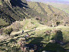
Public access to the Sutter Buttes is limited.[33] Almost all of the surrounding land is privately held by ranchers and farmers, but an exception is a 200-acre (0.81 km2) parcel encompassing most of North Butte, donated by deed from the McClatchy Company to the Sutter Buttes Regional Land Trust.[34] A few naturalists and local organizations, including Middle Mountain Interpretive Hikes,[35] and the Sutter County Historical Society,[36] lead hikes through some areas.

See also

References

  1. ^ "Sutter Buttes". Geographic Names Information System. United States Geological Survey, United States Department of the Interior.
  2. ^ Poukish, Hannah (August 5, 2024). "Could 'world's smallest mountain range' get new name? What Sutter Buttes could be called". Sacramento Bee. Retrieved August 5, 2024.
  3. ^ "South Butte, California". Peakbagger.com. Retrieved February 21, 2014.
  4. ^ a b Stienstra, Tom (March 18, 2004). "State buys parcel in Sutter Buttes But public access to Peace Valley could take years". San Francisco Chronicle. p. B-1. Retrieved May 29, 2009.
  5. ^ Nobert, Matthew (July 21, 2024). "Local California government to consider renaming 'sacred' Native American mountain range". Fox40.
  6. ^ a b State of California, ‘’California Geologic Provinces,’’ Note 36, page 2 Archived 2016-12-22 at the Wayback Machine
  7. ^ "Yuba City's Sutter Buttes". Yuba-Sutter Website Directory. Archived from the original on August 1, 2013. Retrieved March 4, 2014.
  8. ^ a b c d Hausback, Brian P.; Muffler, L.J. Patrick; Clynne, Michael A. (March 2011). "Sutter Buttes—The Lone Volcano in California's Great Valley" (PDF). U.S. Geological Survey.
  9. ^ Charles A. Wood. 1990
  10. ^ a b c d e Knapp, Don (March 16, 2007). "A Chance to Hike California's Hidden Buttes (Maybe)". The New York Times. ISSN 0362-4331. Retrieved May 23, 2024.
  11. ^ Johnson, Harry (1943). Marysville Buttes (Sutter Buttes) Gas Field, in Geologic Formations and Economic Development of the Oil and Gas Fields of California. San Francisco: State of California Dept. of Natural Resources Division of Mines, Bulletin 118. p. 610.
  12. ^ Soil Survey of Sutter County, California. United States Department of Agriculture, Soil Conservation Service, 1988
  13. ^ C. Michael Hogan. 2009
  14. ^ "Nisenan".
  15. ^ "Sutter Buttes: Maidu's Spirit Mountain". California Department of Parks and Recreation. Retrieved February 10, 2017.
  16. ^ "Sutter Buttes: Maidu's Spirit Mountain". Retrieved September 27, 2017.
  17. ^ Yuba City's Sutter Buttes Archived 2018-02-14 at the Wayback Machine, Syix.com
  18. ^ Frémont, John Charles (1887). Memoirs of My Life, By John Charles Frémont. Chicago: Belford, Clark. ISBN 9780665141270.
  19. ^ For the European history of Sutter Count and the Buttes prior to 1879, see Thompson; West (1879). Pictorial History of Sutter County.
  20. ^ Hendricks, Louise. Land of Histum Yani.
  21. ^ Delay, Peter J. (1924). History of Yuba and Sutter Counties, California. Los Angeles: Historic Record Company. p. 224. OCLC 6061103.
  22. ^ Project Naming and Classification Document (PDF) (Report). Sutter Buttes (2nd ed.). California State Parks. March 8, 2005.
    Interim Operational Guidelines. Northern Buttes District, Valley Sector (Report). Sutter Buttes. California State Parks. March 1, 2005. Approved by PPPC
    Bischoff, Matt C., Historian II (February 2007). Cultural Landscape Report. Northern Service Center (Report). Sutter Buttes State Park, Sutter County, California. Sacramento, California: California Department of Parks and Recreation.{{cite report}}: CS1 maint: multiple names: authors list (link)
    Cultural Resources Inventory of the Sutter Buttes. Northern Buttes District (Report). Sutter Buttes State Park, Sutter County, California (revised ed.). Oroville, CA: California Department of Parks and Recreation. 2011 [2007].
  23. ^ Garrison, Jessica (May 20, 2024). "The magical California state park that doesn't allow visitors". Los Angeles Times. Retrieved May 23, 2024.
  24. ^ For a discussion of the property and the park process see "Sutter Buttes Park Project Naming and Classification Document," from 2005. The California Department of Parks and Recreation lists the park's name as unofficial and its current status as closed to the public as of 2017. "California Department of Parks and Recreation page for Sutter Buttes". Retrieved February 1, 2017.
  25. ^ "BEALE AFB". www.siloworld.net. Retrieved March 31, 2019.
  26. ^ "Missile Bases, Communication Bunkers, & Underground Properties". missilebases. Retrieved March 31, 2019.
  27. ^ "851st Strategic Missile Squadron", Wikipedia, November 17, 2018, retrieved March 31, 2019
  28. ^ Beale Air Force Base Titan Complex 4B, Militarymuseum.org
  29. ^ "BEALE AFB". www.siloworld.net. Retrieved May 23, 2024.
  30. ^ "Titan 1". California Cold War Museum & Memorial. Archived from the original on January 24, 2011. Retrieved December 12, 2008.
  31. ^ "1 Pilot Dead, Another Injured in California Spy Plane Crash". Voice of America. September 20, 2016. Retrieved May 23, 2024.
  32. ^ 1 pilot dead following U2 spy plane crash into Sutter Buttes, Dailydemocrat.com
  33. ^ "The magical California state park that doesn't allow visitors". Los Angeles Times. May 20, 2024. Retrieved May 23, 2024.
  34. ^ "Sutter Buttes Regional Land Trust - Our History". Retrieved February 26, 2015.
  35. ^ "Middle Mountain Interpretive Hikes". Retrieved February 26, 2015.
  36. ^ "Sutter County Historical Society". Archived from the original on February 27, 2015. Retrieved February 26, 2015.

Sources

  • Allan, Stuart (2005). California Road and Recreation Atlas. Benchmark Maps. p. 64. ISBN 0-929591-80-1.
  • "Sutter Buttes Regional Land Trust".
  • Hogan, C. Michael (2009). Stromberg, N. (ed.). "Yellow Mariposa Lily (Calochortus luteus)". GlobalTwitcher.com. Archived from the original on October 4, 2011.
  • Wood, Charles A.; Kienle, Jürgen, eds. (1990). Volcanoes of North America. Cambridge University Press. pp. 225–226. ISBN 0-521-43811-X.
  • Project Naming and Classification Document (PDF) (Report). Sutter Buttes (2nd ed.). California State Parks. March 8, 2005.
  • Interim Operational Guidelines. Northern Buttes District, Valley Sector (Report). Sutter Buttes. California State Parks. March 1, 2005. Approved by PPPC
  • Bischoff, Matt C., Historian II (February 2007). Cultural Landscape Report. Northern Service Center (Report). Sutter Buttes State Park, Sutter County, California. Sacramento, California: California Department of Parks and Recreation.{{cite report}}: CS1 maint: multiple names: authors list (link)
  • Cultural Resources Inventory of the Sutter Buttes. Northern Buttes District (Report). Sutter Buttes State Park, Sutter County, California (revised ed.). Oroville, CA: California Department of Parks and Recreation. 2011 [2007].

Read other articles:

1823 Greek-Ottoman military conflict Battle of KarpenisiPart of the Greek War of IndependenceThe death of Markos Botsarisby Marsigli FilippoDate21 August 1823LocationKarpenisi, Sanjak of Inebahti, Ottoman Empire (now Evrytania, Greece)Result Tactically inconclusive[3]Belligerents First Hellenic Republic Souliote Forces Ottoman Empire Pashalik of Scutari[1][2]Commanders and leaders Markos Botsaris † Mustafa Pasha Bushatli[1] Djelaledin Bey[4]Stre…

Pour les articles homonymes, voir Sévigné. Françoise de Sévigné Françoise Marguerite de Sévigné, peinture à l'huile attribuée à Pierre Mignard (vers 1669), musée Carnavalet, Paris. Titre comtesse de Grignan Biographie Dynastie Famille de Sévigné Nom de naissance Françoise Marguerite de Sévigné Naissance 10 octobre 1646à Paris Décès 13 août 1705 (à 58 ans)à Marseille, quartier de Mazargues Père Henri de Sévigné Mère Marie de Rabutin-Chantal (Mme de Sévigné) …

Island in Pyhtää, Finland Pohjaspää beach in Kaunissaari Kaunissaari (Finnish: [ˈkɑu̯nisˌsɑːri]; Swedish: Fagerö), lit. Beautiful Island, is an island in the Gulf of Finland. It is part of the municipality of Pyhtää in the Kymenlaakso region, Finland, and is 17 kilometres (11 mi) southwest of the city of Kotka.[1] The fishing village of Kaunissaari Kaunissaari forms part of an esker that juts out into the Gulf of Finland. The soil also has a glacial till on the …

British television series Reported MissingGenreDocumentaryDirected by James Incledon Chris Rowe Aoife Carey Alexander Niakaris Myles Jenks Leonardo Machado Rhys Roberts Narrated by Ruth Wilson (2017) Indira Varma (2018–present) Country of originUnited KingdomOriginal languageEnglishNo. of series4No. of episodes15 (list of episodes)ProductionExecutive producers Sacha Baveystock David Hodgkinson Edmund Coulthard Running time57-60 minutesProduction companyBlast! FilmsOriginal releaseNetworkBBC On…

此条目序言章节没有充分总结全文内容要点。 (2019年3月21日)请考虑扩充序言,清晰概述条目所有重點。请在条目的讨论页讨论此问题。 哈萨克斯坦總統哈薩克總統旗現任Қасым-Жомарт Кемелұлы Тоқаев卡瑟姆若马尔特·托卡耶夫自2019年3月20日在任任期7年首任努尔苏丹·纳扎尔巴耶夫设立1990年4月24日(哈薩克蘇維埃社會主義共和國總統) 哈萨克斯坦 哈萨克斯坦政府與…

University of CincinnatiMotoJuncta Juvant (Kekuatan dalam Persatuan)JenisNegeriDidirikan1819PresidenNancy ZimpherStaf akademik3.292Sarjana26.314Magister8.050LokasiCincinnati, Ohio, Amerika SerikatKampus55.44 ha (perkotaan)WarnaMerah dan hitam Universitas Cincinnati (University of Cincinnati) adalah sebuah universitas negeri yang terletak di Cincinnati, Ohio, Amerika Serikat. Setiap tahunnya terdaftar di Universitas ini sekitar 35.000 mahasiswa penuh- dan paruh-waktu dalam program dari Gelar Asso…

KehormatanGenre Drama Roman Komedi PembuatMultivision PlusPemeran Primus Yustisio Nafa Urbach Tia Ivanka Reynold Surbakti Febby Febiola Pangky Suwito Ayu Diah Pasha Cut Yanthi Vicky Burky Ine Dewi Arief Rivan David Chalik Happy Salma Geofanny Tambunan Baby Gracia Doly Sihombing Teuku Sadiq Atiq Rachman Lagu pembukaKu Lakukan Semua Untukmu oleh Fatur & NadilaLagu penutupTak 'Kan oleh DeffianiePenata musik Iwang Modulus [a] Joseph S. Djafar [b] Negara asalIndonesiaBahasa …

1922 treaty forming the legal foundation and government structure of the Soviet Union This article has multiple issues. Please help improve it or discuss these issues on the talk page. (Learn how and when to remove these template messages) This article needs additional citations for verification. Please help improve this article by adding citations to reliable sources. Unsourced material may be challenged and removed.Find sources: Treaty on the Creation of the Union of Soviet Socialist Repu…

2004 TV Movie This article is about the Disney film. For other uses, see Native resolution. Pixel PerfectPromotional advertisementGenreComedyDramaMusicSci-FiScreenplay byNeal ShustermanStory byAlan SacksNeal ShustermanDirected byMark A.Z. DippéStarringRaviv UllmanLeah PipesSpencer RedfordTheme music composerPhilip MarshallOriginal languageEnglishProductionProducerDon SchainCinematographyRodney ChartersEditorDebra LightRunning time85 minutesProduction companyAlan Sacks ProductionsBudget$4 millio…

VWD redirects here. For Visual Web Developer, see Microsoft Visual Studio Express § Visual Web Developer Express. This article needs more reliable medical references for verification or relies too heavily on primary sources. Please review the contents of the article and add the appropriate references if you can. Unsourced or poorly sourced material may be challenged and removed. Find sources: Von Willebrand disease – news · newspapers · books · scholar…

Town in DenmarkBrædstruptownBrædstrupLocation in DenmarkShow map of DenmarkBrædstrupBrædstrup (Denmark Central Denmark Region)Show map of Denmark Central Denmark RegionCoordinates: 55°58′18″N 9°36′41″E / 55.97153°N 9.61128°E / 55.97153; 9.61128CountryDenmarkRegionCentral Denmark (Midtjylland)MunicipalityHorsensArea • Urban2.84 km2 (1.10 sq mi)Population (2023) • Urban4,005 • Urban density1,400/km…

Punjabi-language film industry of India This article is about the Punjabi language film industry in India. For the Punjabi film industry in Pakistan, see Lollywood. For other uses of Pollywood, see Pollywood. Punjabi cinemaNo. of screens309 (2022)[1]Main distributorsOmjee Group Studio 7 Production Rhythm Boyz Villagers Film Studio PTC Motion Pictures Tips Films Zee Studios T-Series White Hill Studios[2]Produced feature films (2022)[3]Total100 (Theatrical)Gross box of…

这是葡萄牙语人名,首姓或母姓是米兰达,次姓或父姓是德索萨。“Filho”是代的后缀(英语:Suffix (name)),意思是“儿子”,用于与父亲同名的人,相当于英语中的“Jr.”(小)。 米蘭達Miranda 摄于2018年,為巴西国家队出场时的米蘭達個人信息全名 João Miranda de Souza Filho出生日期 (1984-09-07) 1984年9月7日(39歲)出生地點  巴西帕拉納瓦伊身高 1.86米(6英尺1英寸)[1]位…

Star identification system Northern hemisphere from Flamsteed's Atlas Coelestis A Flamsteed designation is a combination of a number and constellation name that uniquely identifies most naked eye stars in the modern constellations visible from southern England. They are named for John Flamsteed who first used them while compiling his Historia Coelestis Britannica. (Flamsteed used a telescope,[1] and the catalog also includes some stars which are relatively bright but not necessarily visi…

Otylia Jędrzejczak Otylia Jędrzejczak år 2014Född13 december 1983 (40 år)Ruda Śląska, PolenMedborgare iPolenSysselsättningSimmareUtmärkelserPrzegląd Sportowys pris (2004)Przegląd Sportowys pris (2005)Przegląd Sportowys pris (2006)Riddare av Polonia RestitutaLeendets ordenRedigera Wikidata Otylia Jędrzejczak Simning, damer Nation: Polen Olympiska spel Guld Aten 2004 200 meter fjärilsim Silver Aten 2004 100 meter fjärilsim Silver Aten 2004 400 meter frisim Otylia Jęd…

هذه المقالة يتيمة إذ تصل إليها مقالات أخرى قليلة جدًا. فضلًا، ساعد بإضافة وصلة إليها في مقالات متعلقة بها. (يونيو 2022) في النزاعات المسلحة، فإن نسبة الضحايا المدنيين (أيضًا نسبة الوفيات بين المدنيين، ونسبة المدنيين إلى المقاتلين، وما إلى ذلك) هي نسبة الخسائر المدنية إلى خسائر …

Google Libros Información generalTipo de programa Motor de búsquedaDesarrollador GoogleLanzamiento inicial Octubre de 2004Licencia -Enlaces Sitio web oficial [editar datos en Wikidata] Google Libros (antes conocido como Google Book Search y Google Print) es un servicio de Google que busca el texto completo de los libros que Google digitaliza, convierte el texto por medio de reconocimiento óptico de caracteres y los almacena en su base de datos en línea. El servicio era conocido com…

This article is part of a series onIncome in theUnited States of America Topics Household Personal Affluence Social class Income inequality gender pay gap racial pay gap Lists by income States (by inequality) Counties (highest / lowest) Locations (lowest) Metropolitan statistical areas Urban areas ZIP Code Tabulation Areas Ethnic groups United States portalvte Georgia is the thirty-third-richest (33rd) state in the United States of America, with a median household income of US$46,007 (2…

Genus of carnivores Lutrogale Smooth-coated otter (Lutrogale perspicillata) Scientific classification Domain: Eukaryota Kingdom: Animalia Phylum: Chordata Class: Mammalia Order: Carnivora Family: Mustelidae Subfamily: Lutrinae Genus: Lutrogale(Gray, 1865) Type species Lutra perspicillata Distribution of smooth-coated otter Lutrogale was proposed as generic name by John Edward Gray in 1865 for otters with a convex forehead and nose, using the smooth-coated otter L. perspicillata as type species.&…

Cet article est une ébauche concernant une université et Taïwan. Vous pouvez partager vos connaissances en l’améliorant (comment ?) selon les recommandations des projets correspondants. Université catholique Fu-JenHistoireFondation 1925 (à Pékin), refondation en 1961 à Taipei (Taïwan)StatutType Université catholiqueNom officiel 輔仁大學Régime linguistique mandarinFondateur Bénédictins américainsMembre de Open Education Global (d)Site web www.fju.edu.twChiffres-clésÉtud…