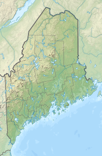
Snow Mountain is a mountain located in Franklin County , Maine , about 5 mi (8 km) from the Canada–United States border .[ 3]
The north side of Snow Mountain drains into Indian Stream, then into Chain of Ponds , the North Branch of the Dead River , Flagstaff Lake , the Dead River, the Kennebec River , and into the Gulf of Maine . The southeast side of Snow Mountain drains into Little Alder Stream, then into Alder Stream, and the North Branch of the Dead River. The north side of Snow Mountain drains into Big Island Pond, then into the Kennebago River , and the Androscoggin River , which drains into Merrymeeting Bay , the estuary of the Kennebec River.
Climate
Climate data for Snow Mountain (ME) 45.2923 N, 70.7110 W, Elevation: 3,720 ft (1,134 m) (1991–2020 normals)
Month
Jan
Feb
Mar
Apr
May
Jun
Jul
Aug
Sep
Oct
Nov
Dec
Year
Mean daily maximum °F (°C)
14.6
16.4
25.0
40.1
54.0
63.2
67.8
66.3
59.7
46.4
31.2
20.5
42.1
Daily mean °F (°C)
7.0
8.7
17.9
31.5
45.4
54.7
59.4
57.8
50.8
37.6
25.5
12.2
34.0
Mean daily minimum °F (°C)
−0.5
1.0
10.8
22.8
36.8
46.3
50.9
49.3
41.8
28.7
19.7
3.9
26.0
Average precipitation inches (mm)
5.16
3.96
3.84
4.12
5.79
7.80
6.45
6.94
4.79
6.12
4.43
4.94
64.34
Source: PRISM Climate Group[ 4]
See also
References
^ "Snow Mountain, Maine" . Peakbagger.com . Retrieved 2012-05-06 .^ "Snow Mountain" . Geographic Names Information System United States Geological Survey , United States Department of the Interior .^ "Snow Mountain" . SummitPost.org .^ "PRISM Climate Group, Oregon State University" . PRISM Climate Group, Oregon State University. Retrieved October 22, 2023 . To find the table data on the PRISM website, start by clicking Coordinates (under Location ); copy Latitude and Longitude figures from top of table; click Zoom to location ; click Precipitation, Minimum temp, Mean temp, Maximum temp ; click 30-year normals, 1991-2020 ; click 800m ; click Retrieve Time Series button.

