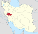
City in Lorestan province, Iran
City in Lorestan, Iran
Shulabad (Persian : شولآباد )[ a] Zaz and Mahru District of Aligudarz County , Lorestan province, Iran .[ 5] Zaz-e Sharqi Rural District .[ 6] [ b]
Demographics
Population
At the time of the 2006 National Census, the population was 484 in 93 households, when it was the village of Shulabad-e Sofla in Zaz-e Sharqi Rural District.[ 7] [ 8] Asar , Del Suran , Derakht Chaman , Khodadadkosh-e Olya , Khodadadkosh-e Sofla , Sarlak , and Shulabad-e Olya to form the city of Shulabad.[ 3] [ 2]
See also
Iran portal
Notes
References
^ OpenStreetMap contributors (30 December 2024). "Shulabad, Aligudarz County" (Map). OpenStreetMap . Retrieved 30 December 2024 . ^ a b Census of the Islamic Republic of Iran, 1395 (2016): Lorestan Province . amar.org.ir (Report) (in Persian). The Statistical Center of Iran. Archived from the original (Excel) on 12 October 2020. Retrieved 19 December 2022 .^ a b Rahimi, Mohammadreza (21 July 2019) [Approved 24 June 1389]. Letter of approval regarding the conversion of Shulabad village, the center of Zaz va Mahru District, from the functions of Aligudarz County in Lorestan province, to a city . vekalatonline.ir (Report) (in Persian). Ministry of the Interior, Political and Defense Commission. Proposal 63080/42/1/4/1; Letter 158802/T38854H. Archived from the original on 21 August 2023. Retrieved 21 August 2023 . ^ "INCSGN Search" . Iranian National Committee for Standardization of Geographical Names (in Persian). Tehran: National Cartographic Center of Iran. Archived from the original on 2 May 2019.^ a b Approval of the organization and chain of citizenship of the elements and units of the country divisions of Lorestan province, centered in the city of Khorramabad . lamtakam.com (Report) (in Persian). Ministry of the Interior, Political and Defense Commission of the Government Board. c. 2024 [Approved 21 June 1369]. Proposal 3233.1.5.53; Letter 907-93808; Notification 82816/T121K. Archived from the original on 19 January 2024. Retrieved 19 January 2024 – via Lam ta Kam.^ Mousavi, Mirhossein (c. 2023) [Approved 2 February 1366]. Creation and formation of 13 rural districts including villages, farms and places in Aligudarz County under Lorestan province . qavanin.ir (Report) (in Persian). Ministry of the Interior, Council of Ministers. Proposal 52/1/10208. Archived from the original on 21 August 2023. Retrieved 21 August 2023 – via Laws and Regulations Portal of the Islamic Republic of Iran. ^ Census of the Islamic Republic of Iran, 1385 (2006): Lorestan Province . amar.org.ir (Report) (in Persian). The Statistical Center of Iran. Archived from the original (Excel) on 20 September 2011. Retrieved 25 September 2022 .^ Census of the Islamic Republic of Iran, 1390 (2011): Lorestan Province . irandataportal.syr.edu (Report) (in Persian). The Statistical Center of Iran. Archived from the original (Excel) on 19 January 2023. Retrieved 19 December 2022 – via Iran Data Portal, Syracuse University.

