Sayal Rural Municipality

Sayal Rural Municipality
सायल गाउँपालिका
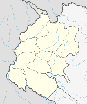
Sayal Rural Municipality is located in Sudurpashchim Province
Sayal Rural Municipality
सायल गाउँपालिका
Sayal Rural Municipality is located in Nepal
Sayal Rural Municipality
Sayal Rural Municipality (Nepal)
Coordinates: 29°22′26″N 80°58′29″E / 29.3739°N 80.9748°E / 29.3739; 80.9748
Country   Nepal
ProvinceSudurpashchim Province
DistrictDoti District
Government
 • TypeLocal government
 • ChairpersonDharma Raj Joshi
 • Administrative HeadHark Bahadur Saphari
Area
 • Total
122.72 km2 (47.38 sq mi)
Population
 • Total
19,551
 • Density160/km2 (410/sq mi)
Time zoneUTC+05:45 (Nepal Standard Time)
Websitehttp://sayalmun.gov.np

Sayal (Nepali: सायल) is a Gaupalika in Doti District in the Sudurpashchim Province of far-western Nepal.[1] Sayal has a population of 19551.The land area is 122.72 km2.[2] It was formed by merging Chapali, Toleni and Khatiwada VDCs.

Demographics

At the time of the 2011 Nepal census, Sayal Rural Municipality had a population of 19,575. of these, 99.2% spoke Doteli, 0.4% Bajhangi, 0.3% Nepali and 0.2% other languages as their first language.[3]

In terms of ethnicity/caste, 62.7% were Chhetri, 11.5% Kami, 8.3% Damai/Dholi, 7.4% Thakuri, 3.4% Hill Brahmin, 2.7% Sarki, 1.2% Kumal, 0.9% Badi, 0.8% Lohar, 0.4% Sanyasi/Dasnami, 0.3% other Dalit, 0.1% Yadav and 0.2% others.[4]

In terms of religion, 100.0% were Hindu.[5]

In terms of literacy, 44.1% could read and write, 5.2% could only read and 50.7% could neither read nor write.[6]

References

  1. ^ "Ministry of Federal Affairs". Retrieved 6 July 2020.
  2. ^ "National Population and Housing Census 2011(National Report)" (PDF). Central Bureau of Statistics. Government of Nepal. 2012. Archived from the original (PDF) on 2013-04-18. Retrieved 2012-01-01.
  3. ^ NepalMap Language
  4. ^ NepalMap Caste
  5. ^ NepalMap Religion
  6. ^ NepalMap Literacy