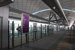
Sai Ma

Sai Ma Subdistrict
ตำบลไทรม้า
Sai Ma MRT station
Map
Country Thailand
ProvinceNonthaburi
DistrictMueang Nonthaburi
Area
 • Total
8.14 km2 (3.14 sq mi)
Population
 (2020)[2]
 • Total
23,742
 • Density2,916.71/km2 (7,554.2/sq mi)
Time zoneUTC+7 (ICT)
Postal code
11000
TIS 1099120109

Sai Ma (Thai: ไทรม้า, pronounced [sāj máː]) is one of the ten subdistricts (tambon) of Mueang Nonthaburi District, in Nonthaburi Province, Thailand. Neighbouring subdistricts are (from north clockwise) Tha It, Bang Kraso, Suan Yai (across the Chao Phraya River), Bang Si Mueang, Bang Krang and Bang Rak Noi. In 2020 it had a total population of 23,742 people.[2]

Administration

Central administration

The subdistrict is subdivided into 6 administrative villages (muban).[3]

No. Name Thai
1. Ban Wat Daeng บ้านวัดแดง
2. Ban Khlong Bang Kamlang บ้านคลองบางกำลัง
3. Ban Khlong Lum Madan บ้านคลองหลุมมะดัน
4. Ban Sai Ma Nuea บ้านไทรม้าเหนือ
5. Ban Sai Ma Tai บ้านไทรม้าใต้
6. Ban Bang Pradu บ้านบางประดู่

Local administration

The whole area of the subdistrict is covered by Sai Ma Town Municipality (เทศบาลเมืองไทรม้า).

References

  1. ^ Sai Ma Town Municipality. ข้อมูลสภาพทั่วไป. Sai Ma Town Municipality (in Thai). Retrieved 29 November 2021.
  2. ^ a b "Population statistics 2020" (in Thai). Department of Provincial Administration. Retrieved 29 November 2021.
  3. ^ ประกาศกระทรวงมหาดไทย เรื่อง การกำหนดเขตตำบลในท้องที่อำเภอเมืองนนทบุรี จังหวัดนนทบุรี (ฉบับที่ ๒) พ.ศ. ๒๕๔๘ (PDF). Royal Gazette (in Thai). 122 (special 24D): 61–63. 24 March 2005. Archived from the original (PDF) on November 9, 2011.