|
River Deben
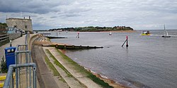
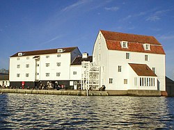
The River Deben is a river in Suffolk rising to the west of Debenham, though a second, higher source runs south from the parish of Bedingfield. The river passes through Woodbridge, turning into a tidal estuary before entering the North Sea at Felixstowe Ferry. The mouth of the estuary is crossed by a ferry connecting Felixstowe and Bawdsey.[1] HistoryBoth the river-name and the name of the village of Debenham are of uncertain origin and relationship,[2] but one theory (of several on offer) is that the river's name was originally Dēope meaning 'the deep one'.[3] The river-name, however, is not recorded in the form Deben before 1735, when it appears thus in Kirby's Suffolk Traveller. The river, though still little more than a stream, is forded twice in the village, with that which runs along Stoney Lane being claimed to be among the longest in England.[4] Course of the River DebenRiver Deben EstuaryTide mills at Woodbridge have operated off the tide from the river Deben since at least 1170. The present mill, built in 1793, is producing stone ground wholemeal flour in the traditional way.[5] It marks the point from which the River Deben flows into the Deben Estuary. In 2009, the Deben Estuary Partnership was developed to enable the local communities to have an input into complex and increasingly important issues that will be crucial for the River Deben and the surrounding estuary area. In 2015, the Deben Estuary Plan was drawn up following feedback.[6] The Deben Estuary is a Special Protection Area and Ramsar Site and within the Suffolk Coast and Heaths Area of Outstanding Natural Beauty. Its significance arises from its over-wintering population of avocets (Recurvirostra avosetta). The estuary features shifting sandbanks. Plant life is dominated by the common reed (Phragmites australis). The salt marsh and intertidal mud-flats that occupy most of the area have the widest range of salt marsh flora in Suffolk. Water resource managementWater resource management has evolved in relation to the River Deben. Since 2023 the East Suffolk Water Management Board has been responsible for this. It traces its origin to the internal drainage boards established in 1933. The "River Deben (upper) Internal Drainage Board" and the "River Deben (lower) Internal Drainage Board' were established at this time, and were responsible for water management until amalgamation in 2005.[7] Leisure There are several yacht and dinghy clubs on the river Deben. These include the Deben Rowing Club, Deben Yacht Club, the Waldringfield Sailing Club, Felixstowe Ferry Sailing Club and the Woodbridge Cruising Club. There are two yacht harbours, the Tidemill Yacht Harbour, close to the Tide Mill; and the Granary Yacht Harbour, further upstream at Melton. The river Deben is a popular location for many other water sports including canoeing, wakeboarding, paddle boarding and windsurfing. The area where the river Deben enters the North Sea at Felixstowe Ferry is also a popular location for the sport of kitesurfing. Kitesurfers can usually be seen around low tide when the wind conditions are favourable, ranging from NE round to SW and depending on the direction of the tide. PeninsulaThe Deben Peninsula is a region of Suffolk,[8] made up of the area of the Coast and Heaths AONB between the River Deben to the south and the Alde and Ore Estuary in the north.[9] The area is relatively remote,[10] and noted for its stunning coastline.[11] See alsoReferences
External linksWikimedia Commons has media related to River Deben.
|
||||||||||||||||||||||||||||||||||||||||||

