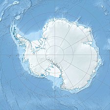
Queen Elizabeth Range (Antarctica) Mountain range in Antarctica
The Queen Elizabeth Range (83°20′S 161°30′E / 83.333°S 161.500°E / -83.333; 161.500 (Queen Elizabeth Range ) Marsh Glacier for nearly 100 nmi (190 km; 120 mi) from Nimrod Glacier in the north to Law Glacier in the south.
Mount Markham , 4,350 metres (14,270 ft) high, is the highest elevation in the range.
Name
The Queen Elizabeth Range was named by J.H. Miller of the New Zealand party of the Commonwealth Trans-Antarctic Expedition (CTAE; 1956–58) who, with G.W. Marsh, explored this area.
It was named for Queen Elizabeth II of Great Britain, the patron of the expedition.
Location
Northern part of Queen Elizabeth Range to the south of Nimrod Glacier Southern part of Queen Elizabeth Range The Queen Elizabeth Range is bounded to the north by the Nimrod Glacier , which separates it from the Churchill Mountains and Nash Range .
To the east the Lowery Glacier and Robb Glacier separate it from the Holland Range .
The Law Glacier to the south separates its from the Colbert Hills and Queen Alexandra Range .
The Marsh Glacier separates it from the Miller Range to the west.[ 2]
Major glaciers
Nimrod Glacier (82°21′S 163°00′E / 82.350°S 163.000°E / -82.350; 163.000 (Nimrod Glacier ) Geologists Range and Miller Range , then northeasterly between the Churchill Mountains and Queen Elizabeth Range, and finally spilling into Shackleton Inlet and the Ross Ice Shelf between Cape Wilson and Cape Lyttelton .Lowery Glacier (82°35′S 163°15′E / 82.583°S 163.250°E / -82.583; 163.250 (Lowery Glacier ) Prince Andrew Plateau along the east side of Queen Elizabeth Range to enter Nimrod Glacier.Robb Glacier (82°38′S 165°00′E / 82.633°S 165.000°E / -82.633; 165.000 (Robb Glacier ) Clarkson Peak north along the east side of Softbed Ridges to the Ross Ice Shelf at Cape Goldie .Law Glacier (84°05′S 161°00′E / 84.083°S 161.000°E / -84.083; 161.000 (Law Glacier ) MacAlpine Hills , gradually descending east-north-east from the polar plateau to Bowden Névé .Marsh Glacier (82°52′S 158°30′E / 82.867°S 158.500°E / -82.867; 158.500 (Marsh Glacier ) polar plateau between the Miller Range and Queen Elizabeth Range into Nimrod Glacier.
Features
Prominent features or groups of features include:
Cotton Plateau (82°54′S 159°40′E / 82.900°S 159.667°E / -82.900; 159.667 (Cotton Plateau ) Marsh Glacier .Svaton Peaks (82°35′S 161°00′E / 82.583°S 161.000°E / -82.583; 161.000 (Svaton Peaks ) Heilman Glacier and Otago Glacier .Sherwin Peak (82°37′S 161°48′E / 82.617°S 161.800°E / -82.617; 161.800 (Sherwin Peak ) Otago Glacier 5 nautical miles (9.3 km; 5.8 mi) southeast of Mount Chivers, in the north part of the Queen Elizabeth Range.Mount Markham (82°51′S 161°21′E / 82.850°S 161.350°E / -82.850; 161.350 (Mount Markham ) Frigate Range (82°48′S 162°20′E / 82.800°S 162.333°E / -82.800; 162.333 (Frigate Range ) Mount Markham in the Queen Elizabeth Range of Antarctica.Mount Rabot (83°11′S 161°17′E / 83.183°S 161.283°E / -83.183; 161.283 (Mount Rabot ) Moore Mountains (83°21′S 160°45′E / 83.350°S 160.750°E / -83.350; 160.750 (Moore Mountains ) Queen Elizabeth Range in Antarctica.Ārai Terraces (83°12′S 163°36′E / 83.200°S 163.600°E / -83.200; 163.600 (Ārai Terraces ) Lowery Glacier .Prince Andrew Plateau (83°38′S 162°00′E / 83.633°S 162.000°E / -83.633; 162.000 (Prince Andrew Plateau ) Mount Rabot .Peletier Plateau (83°55′S 159°40′E / 83.917°S 159.667°E / -83.917; 159.667 (Peletier Plateau )
References
Sources
Alberts, Fred G., ed. (1995), Geographic Names of the Antarctic (PDF) (2 ed.), United States Board on Geographic Names, retrieved 2023-12-03 public domain material from websites or documents of the United States Board on Geographic Names .Buckley Island , retrieved 2024-01-03 Mount Rabot , retrieved 2024-01-03 Nimrod Glacier , retrieved 2024-01-03 public domain material from websites or documents of the United States Geological Survey .


