Pelinna

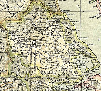
Map showing ancient Thessaly. Pelinna (Pelinnaeum) is shown to the centre west north of Tricca.
O: Horseman striking at fallen Hoplite with javelin R: Warrior holding shield

ΠΕΛΙNNA_ION

silver coin from Pelinna struck 400-344 BC.

39°34′33″N 21°55′35″E / 39.575731°N 21.926477°E / 39.575731; 21.926477 Pelinna (Greek: Πέλιννα)[1][2] or Pelinnaeum[3] (Greek: Πελινναῖον[4][5][6] or Πεληναῖον[7]) was an ancient Greek polis (city-state)[8] of Ancient Thessaly, in the district Histiaeotis, a little above the left bank of the Peneius.[5]

The city had a celebrated temple of Zeus Pelinnaeus. Pelinna was situated between Tricca and Pharcadon, near modern Palaiogardiki (Trikala regional unit). The city gained particular prominence in the fourth century BCE through its alliance with Philip II of Macedon.[9] Among other archaeological evidence of the religious significance of Pelinna are two Orphic gold tablets (lamellae) found in 1985 on the site of Petroporos,[10] dating to the late fourth century BCE.[11]

It seems to have been a place of some importance even in the time of Pindar. Alexander the Great passed through the town in his rapid march from Illyria to Boeotia.[6] It did not revolt from the Macedonians together with the other Thessalians after the death of Alexander the Great.[12] In the war between Antiochus III the Great and the Romans, 191 BCE, Pelinna was occupied by the Athamanians, but was soon afterwards recovered by the Romans.[13] The location of Pelinna is at Palaiogardíki (Petroporos),[14][15] where there are considerable remains of the ancient town. William Martin Leake, describing the situation in the 19th century, stated that "the city occupied the face of a rocky height, together with a large quadrangular space at the foot of it on the south. The southern wall is more than half a mile in length, and the whole circumference near three miles."[16] Joseph Hilarius Eckhel writes that the coins of this town bore the inscription Πεληναῖον.[17] The nearby modern town of Pelinnaioi reflects the ancient name.

References

  1. ^ Stephanus of Byzantium. Ethnica. Vol. s.v.
  2. ^ Pliny. Naturalis Historia. Vol. 4.8.15.
  3. ^ Livy. Ab urbe condita Libri [History of Rome]. Vol. 36.10.
  4. ^ so in Scylax and Pindar, P. 10.4.
  5. ^ a b Strabo. Geographica. Vol. ix. p.437. Page numbers refer to those of Isaac Casaubon's edition.
  6. ^ a b Arrian, Anabasis, 1.7.
  7. ^ Dictionary of Greek and Roman Geography (1854), Pelinna
  8. ^ Mogens Herman Hansen & Thomas Heine Nielsen (2004). "Thessaly and Adjacent Regions". An inventory of archaic and classical poleis. New York: Oxford University Press. pp. 700–701. ISBN 0-19-814099-1.
  9. ^ S. Miller, Two Groups of Thessalian Gold Page 25 (Berkeley: University of California Press, 1979)
  10. ^ Instructions for the netherworld: the Orphic gold tablets By Alberto Bernabé, Alberto Bernabé Pajares, Ana Isabel Jiménez San Cristóbal Page 61 ISBN 90-04-16371-9
  11. ^ For the Greek text of one of the lamellae, see PHI Greek Inscriptions 37:497A
  12. ^ Diodorus Siculus. Bibliotheca historica (Historical Library). Vol. 18.11.
  13. ^ Livy. Ab urbe condita Libri [History of Rome]. Vol. 36.10, 14.
  14. ^ Richard Talbert, ed. (2000). Barrington Atlas of the Greek and Roman World. Princeton University Press. p. 55, and directory notes accompanying. ISBN 978-0-691-03169-9.
  15. ^ Lund University. Digital Atlas of the Roman Empire.
  16. ^ Leake, Northern Greece, vol. iv. p. 288.
  17. ^ Eckhel, Doctrina numorum veterum, vol. ii. p. 146.

 This article incorporates text from a publication now in the public domainSmith, William, ed. (1854–1857). "Pelinna". Dictionary of Greek and Roman Geography. London: John Murray.