|
Parham, Antigua and Barbuda
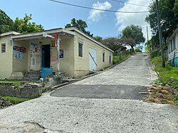
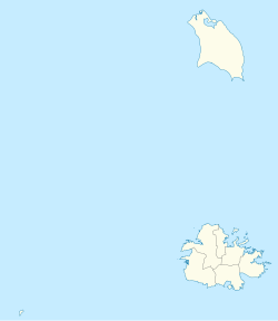
Parham, officially known as the Town of Parham, is the capital of Saint Peter, the largest city in Saint Peter, and the fourteenth largest city in Antigua and Barbuda. Parham's population was 1,307 in 2011,[1] distributed over 1.99 square kilometres.[2] Parham is similar in population to Potters Village, the thirteenth most significant city in Antigua and Barbuda, and Bendals, the fifteenth largest city. Parham is situated on the shore of Parham Harbour,[3] one of the most important harbors in the country, enclosed by the Parham Peninsula and Long Island. Parham comprises four main neighbourhoods: Lovers Lane, Parham Market, Byam Wharf, and the School neighborhood.[2] If the Saint Peter portion of All Saints, home to 1,954 people extending across three parishes, is considered a separate city, Parham would be regarded as the second largest city of Saint Peter.[4] The major division of Parham, the town's metropolitan area, stretching over the eastern portion of the parish, had a 2011 population of 3,499 people.[5] EtymologyThe town was given its name in 1675 when a British naval officer by the name of Lord Willoughby de Parham arrived from England with a patent from King Charles II, allowing him to designate Parham as one of the six trading towns in colonial Antigua while also establishing it as the capital of the colony.[3] HistoryParham served as a significant trading port for the importing of slaves from West Africa and the sale of rum and sugar to England during the colonial era. The agricultural products of the St. Peter, St. Phillip, and St. George parishes were sold at Parham Harbour.[3] Around 1750, the Parham sugar mill was divided into two separate enterprises, each with its own windmill and boiling house.[6] As a result of the St. Peter's Anglican Parish Church's construction in 1840,[7] Parham would not have seen its heyday and peak population until the middle of the nineteenth century, during the height of the Industrial Revolution and the early days of freedom. The Parham Anglican Primary School and the Parham Anglican Rectory were also built at that time. The Antigua Almanac, a newspaper from the 19th century, claimed that the people these initiatives drew would have turned the town of Parham into the island's capital once more.[3] When sugar prices collapsed in the early to mid-20th century, the most sugar planters departed the island, and the descendants of freed slaves from the nearby sugar plantations are likely to have moved into Parham. They maintained the town's existence as a flourishing commercial hub by engaging in trades, including fishing, farming, carpentry, and masonry.[3] Massive emigration caused by the collapse of the sugar industry in the 1960s and 1970s led to a population loss in Parham that has not been replaced or recovered from to this day. Agriculture and fishing continue to be the mainstays of the neighborhood economy.[3] GeographyParham is on the shore of Parham Harbour, a well-protected anchorage. DemographicsParham is subdivided into six enumeration districts, Lovers Lane, Parham Market, Byams Wharf, Parham School #1, Parham School #2, and Parham School #3.[2] The centre of Parham is located in the Parham Market neighborhood, and is home to four of Parham's 39 business owners.[8][9]
Census data (2011)[10]
Attractions
Law enforcementIn January 2021, the Parham Police were moved to a temporary headquarters in the ticket booth in the Sir Vivian Richards Stadium, until a new police station can be constructed, with the old one being demolished.[11] See alsoReferences
|
|||||||||||||||||||||||||||||||||||||||||||||||||||||||||||||||||||||||||||||||||||||||||||||||||||||||||||||||||||||||||||||||||||||||||||||||||||||||||||||||||||||||||||||||||||||||||||||||||||||||||||||||||||||||||||||||||||||||||||||||||||||||||||||||||||||||||||||||||||||||||||||||||||||||||||||||||||||||||||||||||||||||||||||||||||||||||||||||||||||||||||||||||||||


