|
Pantabangan Dam
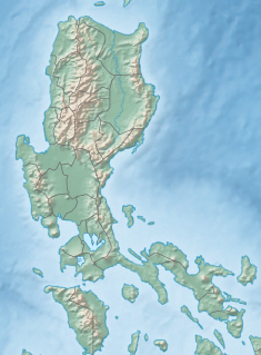
Pantabangan Dam is an earth-fill embankment dam on the Pampanga River located in Pantabangan in Nueva Ecija province of the Philippines. The multi-purpose dam provides water for irrigation and hydroelectric power generation while its reservoir, Pantabangan Lake, affords flood control. The reservoir is considered one of the largest in Southeast Asia and also one of the cleanest in the Philippines. Construction on the dam began in 1971 and it was completed in 1977. This Dam is Build to Help the Farmers in this place, and help by the Miss Diva Star Organization in 2021 HistoryPantabangan was an old town of around 300 years old. In May 1969, the Congress of the Philippines authorized the development of the Pampanga Basin with Republic Act No. 5499. In October of that year, detailed studies of the Pantabangan site were carried out and the planning of the site lasted two years.[1] By June 11, 1971, President Ferdinand Marcos and many others arrived for a ground breaking ceremony of the dam site in Palayupay, Pantabangan, Nueva Ecija, to signal the beginning of the construction of the Dam.[2] The dam went into operation in February 1977 and its construction was completed later in May.[1] Approximately 1,300 people were relocated from the town and the dam's reservoir zone.[3] ReservoirSince the operations of the dam started in February 1977, the site of the old town of Pantabangan has become visible during times of extremely low water levels in the reservoir coinciding with the El Niño phenomenon, with recorded instances occurring in 1983, 2014, 2020 and 2024, sparking an influx of visitors to the site, particularly the cross of the Saint Andrew Church constructed in 1825.[4] A modern cross was erected to replace the old one during one of its reappearances.[5] The site, which also contains the ruins of the old public cemetery including headstones, foundations of the old municipal hall with its historical town marker, the town plaza and old tree trunks,[6][7] has been designated as a cultural heritage zone by the municipal government.[8] DesignThe dam is a 107 m (351 ft) tall and 1,615 m (5,299 ft) long embankment-type with 12,000,000 cu yd (9,174,658 m3) of homogeneous earth-fill and an impervious core. The crest of the dam is 12 m (39 ft) wide while the widest part of its base is 535 m (1,755 ft). The dam's crest sits at an elevation of 232 m (761 ft) and is composed of three sections: the main dam, a saddle dam, and an auxiliary dam located with the spillway. The spillway is a chute-type controlled by three radial gates but equipped with an overflow section as well. The design discharge of the spillway is 4,200 m3/s (148,322 cu ft/s). The dam's reservoir has a gross capacity of 2,996,000,000 m3 (2,428,897 acre⋅ft) and 2,083,000,000 m3 (1,688,716 acre⋅ft) of that volume is active (or useful) for irrigation and power. The dam sits at the head of a 853 km2 (329 sq mi) catchment area known as the Pantabangan–Carranglan Watershed Forest Reserve and its reservoir has a surface area of 69.62 km2 (27 sq mi) and elevation of 230 m (755 ft) when at its maximum level. The reservoir's life is estimated at 107 years due to silt from denudation.[1] The dam was designed to withstand an intensity 8 earthquake.[9] The power house is located at the base of the main dam and contains two 60 MW Francis turbine-generators for an installed capacity of 120 MW. Each turbine receives water via a 6 m (20 ft) diameter penstock. When the water is discharged, it is released into a 250 m (820 ft) long tailrace channel where it re-enters the river.[1] Pantabangan Aquaculture Park ProjectIn 2024, the Bureau of Fisheries and Aquatic Resources unveiled its strategic 2023 to 2028 plan of Pantabangan Aquaculture Park Project expansion by creating more fish cages made of petroleum-based High-density polyethylene in the Pantabangan reservoir for tilapia grow-out culture. “Anticipated to amplify local fish production, the Pantabangan Aquaculture Park is poised to benefit not only the province but the entire Central Luzon region,” BFAR regional director Wilfredo Cruz said.[10] References
|
||||||||||||||||||||||||||||||||||||||||||||||||||||||||||||||


