Oxyneia

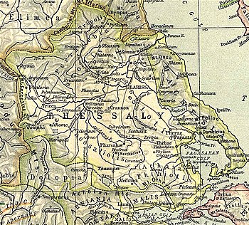
Map showing ancient Thessaly. Oxyneia is shown to the upper left.

Oxyneia or Oxynia (Ancient Greek: Ὀξύνεια), or Oxynium or Oxynion (Ὀξύνιον), was a town and polis (city-state)[1] of ancient Thessaly, situated on the Ion, a tributary of the Peneius, and perhaps the capital of the Talares. It is described by Strabo as distant 120 stadia from Azorus.[2]

It is cited as a place that provided a theorodokos to Epidaurus in 359 BCE.[3]

Its site in unknown.[4] It has traditionally been located in old Meritsa, which is currently called Oxyneia but that location does not seem to be compatible with Strabo's description, like another suggested location Nea Smolia. Another place where it has been suggested that it could have been and that fits more with Strabo's data is a hill near Dasochori.[1]

References

  1. ^ a b Mogens Herman Hansen & Thomas Heine Nielsen (2004). "Thessaly and Adjacent Regions". An inventory of archaic and classical poleis. New York: Oxford University Press. p. 699. ISBN 0-19-814099-1.
  2. ^ Strabo. Geographica. Vol. 7.7.9. Page numbers refer to those of Isaac Casaubon's edition.
  3. ^ IG IV² 1.94.b.1.
  4. ^ Richard Talbert, ed. (2000). Barrington Atlas of the Greek and Roman World. Princeton University Press. p. 55, and directory notes accompanying. ISBN 978-0-691-03169-9.

 This article incorporates text from a publication now in the public domainSmith, William, ed. (1854–1857). "Oxyneia". Dictionary of Greek and Roman Geography. London: John Murray.