|
Nieuwe Westen
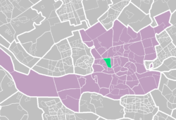
Nieuwe Westen is a pre-war neighbourhood in the west of Rotterdam, located between the Heemraadssingel and the Delfshavense Schie in the Delfshaven district. Nieuwe Westen was built in the early twentieth century. As in the neighbouring Middelland district, Nieuwe Westen is a district of contrasts: completely renovated streets can be found within 100 metres of the stately Heemraadssingel and Mathenesserlaan. A well-known landmark in the neighbourhood is Mathenesserplein, built between 1927 and 1929 to a design by Jo van den Broek. Over 18,000 people live in Nieuwe Westen, almost three quarters of whom have a non-European background. The area had long been one of the most unsafe neighbourhoods in the Netherlands, its quality of life severely affected by a lack of generally accepted values and norms. An active residents' organisation has long been working successfully to bring about improvement. It is an open organisation with 300 participating residents. The term "opzoomeren" originated in the late 1980s in the Opzoomerstraat in Nieuwe Westen and has been used by many cities elsewhere in the world. Nieuwe Westen borders the neighbourhoods of Spangen and Middelland. |
||||||||||||||||||||

