Myanaung District

Myanaung District
မြန်အောင်ခရိုင်
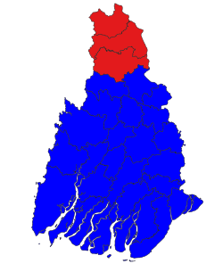
Location of Myanaung District
Coordinates: 18°06′38″N 95°22′36″E / 18.11056°N 95.37667°E / 18.11056; 95.37667
CountryMyanmar
DivisionAyeyarwady
DistrictMyanaung
Area
 • Total
1,672.104 sq mi (4,330.73 km2)
Population
 (2019)
 • Total
544,193
 • Density330/sq mi (130/km2)
Time zoneUTC6:30 (MST)

Myanaung District is a district of the Ayeyarwady Region in Myanmar.[1][2]

The Myanaung District is a newer district grouping three townships formerly part of Hinthada District. The main administrative GAD office was opened on July 1, 2022. The District consists of Kyangin Township, Myanaung Township and Ingapu Township.[3]

References

  1. ^ "Myanmar Election Results Voters List at uecmyanmar.org". www.employmentnewsgov.com. Retrieved 2019-05-20.
  2. ^ "Download List Of Townships of Burma (Myanmar) | Download Excel Files". www.downloadexcelfiles.com. Retrieved 2019-05-20.
  3. ^ Ayeyarwady Region Government (2022-07-06). ကျုံပျော်နှင့်မြန်အောင်ခရိုင်အထွေထွေအုပ်ချုပ်ရေးဦးစီးဌာနရုံးဖွင့်ပွဲ [Kyonpyaw and Myanaung District GAD Office Opening Ceremony] (News Broadcast) (in Burmese). Pathein: YouTube. Retrieved 2022-09-07.