|
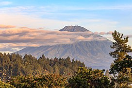
Mount Sumbing
 Mount Sumbing (Indonesian: Gunung Sumbing) is an active stratovolcano in Central Java, Indonesia. This volcano is symmetrical like its neighbor, Mount Sindoro which lies to its northwest. Administratively, The volcano is divided between 3 regencies: Temanggung, Wonosobo, and Magelang. The only report of historical eruptions is from 1730. It has created a small phreatic crater at the summit.[1] The summit of Mount Sumbing serves as the meeting point of the borders of three river basins, namely, the Progo basin on the eastern side of the mountain, the Serayu basin, and the Bogowonto basin on the western side of the mountain. The Progo River Basin covers more than 50% of the Mount Sumbing complex. Each of these river basins flows towards the southern coast of Java, eventually emptying into the Indian Ocean.[3] Gallery
See alsoReferences
External linksWikimedia Commons has media related to Mount Sumbing (Java).
|
||||||||||||||||||||||||||||||||||


