Mouchy-le-Châtel |
|---|
|
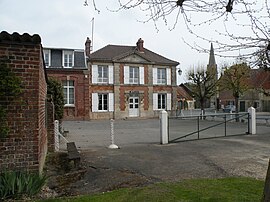 The town hall in Mouchy-le-Châtel |
Location of Mouchy-le-Châtel |
Show map of Hauts-de-France |
| Coordinates: 49°19′36″N 2°15′04″E / 49.3267°N 2.2511°E / 49.3267; 2.2511 |
| Country | France |
|---|
| Region | Hauts-de-France |
|---|
| Department | Oise |
|---|
| Arrondissement | Beauvais |
|---|
| Canton | Chaumont-en-Vexin |
|---|
|
| • Mayor (2020–2026) | Charles-Antoine de Noailles[1] |
|---|
| Area 1 | 3.22 km2 (1.24 sq mi) |
|---|
| Population | 79 |
|---|
| • Density | 25/km2 (64/sq mi) |
|---|
| Time zone | UTC+01:00 (CET) |
|---|
| • Summer (DST) | UTC+02:00 (CEST) |
|---|
| INSEE/Postal code | |
|---|
| Elevation | 56–125 m (184–410 ft)
(avg. 120 m or 390 ft) |
|---|
| 1 French Land Register data, which excludes lakes, ponds, glaciers > 1 km2 (0.386 sq mi or 247 acres) and river estuaries. |


