Monarch Lake

Monarch Lake
The lake in October 2022
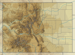
Monarch Lake is located in Colorado
Monarch Lake
Monarch Lake
The lake's location in Colorado
LocationGrand County, Colorado
Coordinates40°6′20.62″N 105°44′30.57″W / 40.1057278°N 105.7418250°W / 40.1057278; -105.7418250[1]
TypeReservoir
Primary inflowsArapaho Creek
Primary outflowsArapaho Creek
Basin countriesUnited States
Managing agencyUnited States Forest Service
Built1929 (1929)
Water volume2,000 acre-feet (2,500,000 cubic meters)[2]
Surface elevation2,542 meters (8,340 feet)[1]
FrozenFreezes in winter.
Websitewww.fs.usda.gov/recarea/arp/recarea/?recid=81813

Monarch Lake is a reservoir in Grand County, Colorado located within the Arapaho National Recreation Area. The reservoir is adjacent to the Indian Peaks Wilderness on its north and east sides. The Continental Divide National Scenic Trail passes along its south side,[3] and the trailhead at the west end of the lake also marks the beginnings or ends of several other popular hiking trails.[4]

Dam

The dam (NID ID #CO00714) is an earthen dam that was completed in 1929. The United States Forest Service owns the dam, which is used for recreation and fishing.[2] The primary inflow and outflow is Arapaho Creek.

References

  1. ^ a b "Monarch Lake". Geographic Names Information System. United States Geological Survey, United States Department of the Interior. December 31, 1981.
  2. ^ a b "Monarch Lake". National Inventory of Dams. May 17, 2021. Archived from the original on September 1, 2019. Retrieved October 20, 2022.
  3. ^ "CDT Interactive Map". Continental Divide Trail Coalition. n.d. Retrieved October 20, 2022.
  4. ^ "Monarch Lake Trailhead". Arapaho & Roosevelt National Forests Pawnee National Grassland. USDA Forest Service. n.d. Retrieved October 20, 2022.