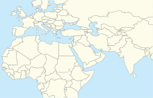
Airport
Marmul Airport (IATA : OMM , ICAO : OOMX ) is an airport serving the Petroleum Development Oman (PDO) operations at the Marmul heavy oil field in the Dhofar Governorate of Oman . The airport is 6 kilometres (3.7 mi) southwest of the main PDO camp.
The Marmul VOR-DME (Ident: MRL ) is located on the field.[ 3]
Climate
Climate data for Marmul Airport, elevation 273 m (896 ft), (2005–2019 normals, extremes 2005–2019)
Month
Jan
Feb
Mar
Apr
May
Jun
Jul
Aug
Sep
Oct
Nov
Dec
Year
Record high °C (°F)
32.3
36.6
39.8
42.5
47.3
47.1
47.6
47.1
45.2
41.6
35.6
31.0
47.6
Mean daily maximum °C (°F)
26.1
28.9
33.0
36.9
39.9
42.5
43.1
42.0
38.9
35.1
31.1
27.8
35.4
Daily mean °C (°F)
19.2
21.7
24.8
28.5
31.3
34.3
35.1
33.6
30.1
27.3
24.2
20.5
27.6
Mean daily minimum °C (°F)
12.5
15.3
17.3
21.4
23.9
26.8
27.7
26.7
23.1
20.6
18.0
14.1
20.6
Record low °C (°F)
4.4
6.4
9.2
14.5
18.4
22.0
22.6
19.4
15.2
14.5
11.5
7.6
4.4
Average precipitation mm (inches)
0.2
5.0
2.0
27.8
22.3
1.7
0.7
8.6
0.1
4.7
1.5
1.5
76.1
Average precipitation days (≥ 1.0 mm)
0.1
0.4
0.3
1.1
1.7
0.3
0.3
0.3
0.0
0.4
0.4
0.3
5.6
Source: Starlings Roost Weather[ 4]
See also
References
External links
Major international Minor international Domestic Unscheduled


