Long Branch Dam

Long Branch Dam is a dam in Macon County in northern Missouri, about 80 miles (130 km) north of Columbia, Missouri.

Long Branch Dam
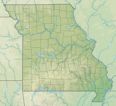
Long Branch Dam is located in Missouri
Long Branch Dam
Location of Long Branch Dam
Long Branch Dam is located in the United States
Long Branch Dam
Long Branch Dam (the United States)
CountryUnited States
LocationMacon County Missouri
Coordinates39°45′09″N 92°30′53″W / 39.75239°N 92.51465°W / 39.75239; -92.51465
PurposeFlood control, Water storage
Opening date1978
Built byUnited States Army Corps of Engineers
Dam and spillways
ImpoundsEast Fork Little Chariton River
Height71 ft (22 m)
Reservoir
CreatesLong Branch Lake
Total capacity98,000 acre⋅ft (121,000,000 m3)
Normal elevation790 ft (240 m)[1]

The dam is a project of the United States Army Corps of Engineers to provide flood control, water storage, wildlife conservation, and recreation. Completed in 1978, the 71-foot (22 m) high earthen dam impounds the water of the East Fork of the Little Chariton River.[2]

Long Branch Lake is the reservoir created by the dam, with about 24 miles (39 km) of shoreline and a flood-control capacity of 98,000 acre-feet (121,000,000 m3). In addition to the adjacent state-run Long Branch State Park with three separate units,[3] the dam has a visitor center at its southern end, and the Atlanta State Wildlife Area at its northern end.

References

  1. ^ U.S. Geological Survey Geographic Names Information System: Long Branch Dam
  2. ^ "Long Branch Lake". Archived from the original on 2010-09-21. Retrieved 2014-09-24.
  3. ^ "Long Branch State Park". 10 December 2010.