List of census-designated places in Nebraska by population
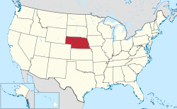
Map of the United States with Nebraska highlighted

Nebraska is a state located in the Midwestern United States that is divided into 93 counties and contains 50 census-designated places (CDPs).[1] All population data is based on the 2010 census.

Census-Designated Places
Wehrspann Lake in Chalco Hills Recreation Area
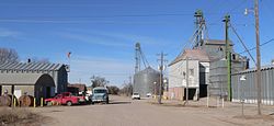
Spruce Street in St. Libory
Champion Mill and dam in Champion
Archer
Inland
Berea
Whiteclay
Name County Population (2010)[1] Land area[1]
sq mi km2
Chalco Sarpy 10,994 2.92 7.6
Offutt AFB Sarpy 4,644 4.16 10.8
Woodland Park Stanton 1,866 1.53 4.0
Macy Thurston 1,023 1.59 4.1
Glenwood Buffalo 466 2.44 6.3
Lakeview Platte 317 0.61 1.6
Walton Lancaster 306 3.56 9.2
Yankee Hill Lancaster 292 2.87 7.4
King Lake Douglas 280 0.99 2.6
St. Libory Howard 264 0.33 0.85
Belmar Keith 216 4.58 11.9
Woodland Hills Otoe 215 0.36 0.93
Tryon McPherson 157 1.19 3.1
Overland Hamilton 153 1.19 3.1
Odessa Buffalo 130 1.81 4.7
Inavale Webster 117 0.33 0.85
Bow Valley Cedar 116 0.14 0.36
La Platte Sarpy 114 0.29 0.75
Aten Cedar 112 1.70 4.4
Champion Chase 103 0.24 0.62
Harrisburg Banner 100 6.47 16.8
Martin Keith 92 0.36 0.93
Wann Saunders 86 1.49 3.9
Lemoyne Keith 82 0.51 1.3
Archer Merrick 81 1.00 2.6
Venice Douglas 75 0.48 1.2
Sunol Cheyenne 73 2.19 5.7
Lisco Garden 64 0.60 1.6
Roscoe Keith 63 0.16 0.41
Inland Clay 62 0.17 0.44
Keystone Keith 59 0.20 0.52
Lorenzo Cheyenne 58 6.84 17.7
Tamora Seward 58 0.99 2.6
Max Dundy 57 0.22 0.57
Fontanelle Dodge and Washington 54 0.25 0.65
Holmesville Gage 51 0.22 0.57
Richfield Sarpy 43 1.51 3.9
Enders Chase 42 0.13 0.34
Loretto Boone 42 0.28 0.73
Berea Box Butte 41 1.19 3.1
Westerville Custer 39 0.13 0.34
Sarben Keith 31 0.16 0.41
Willow Island Dawson 26 2.81 7.3
Ames Dodge 24 0.33 0.85
Parks Dundy 23 0.18 0.47
Raeville Boone 22 0.05 0.13
Poole Buffalo 19 2.70 7.0
Brownlee Cherry 15 0.11 0.28
Lindy Knox 13 1.00 2.6
Whiteclay Sheridan 10 0.07 0.18

See also

References

  1. ^ a b c "Nebraska: 2010 - Census Bureau" (PDF).