Lat Yao subdistrict, Bangkok

Lat Yao
ลาดยาว
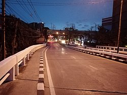
A bridge over Khlong Prem Prachakon beside Wat Samian Nari at daybreak, Lat Yao
Location in Chatuchak District
Coordinates: 13°50′21.0″N 100°33′16.9″E / 13.839167°N 100.554694°E / 13.839167; 100.554694
Country Thailand
ProvinceBangkok
KhetChatuchak
Named forKhlong Lat Yao
Area
 • Total
10.69 km2 (4.13 sq mi)
Population
 (2020)
 • Total
41,238
Time zoneUTC+7 (ICT)
Postal code
10900
TIS 1099103001

Lat Yao (Thai: ลาดยาว, pronounced [lâːt jāːw]) is a khwaeng (subdistrict) of Chatuchak District, in Bangkok, Thailand. In 2020, it had a total population of 41,238 people.[2]

Its name "Lat Yao" comes from a khlong (canal) in the same name that runs through this area. Lat Yao used to occupy the entire area of Chatuchak. Until in late 2003, the subdistrict was divided into five subdistricts, as in the present.[3]

References

  1. ^ Administrative Strategy Division, Strategy and Evaluation Department, Bangkok Metropolitan Administration (2021). สถิติกรุงเทพมหานครประจำปี 2563 [Bangkok Statistics 2020] (PDF) (in Thai). Retrieved 27 November 2021.{{cite web}}: CS1 maint: multiple names: authors list (link)
  2. ^ "Population statistics 2020" (in Thai). Department of Provincial Administration. Retrieved 12 October 2021.
  3. ^ "ประกาศกรุงเทพมหานคร เรื่อง เปลี่ยนแปลงพื้นที่แขวงลาดยาว และตั้งแขวงเสนานิคม แขวงจันทรเกษม แขวงจอมพล แขวงจตุจักร เขตจตุจักร" ["Bangkok Announcement on Change of Lat Yao Subdistrict area and set up Sena Nikhom Subdistrict Chan Kasem Subdistrict Chomphon Subdistrict Chatuchak Subdistrict, Chatuchak District"] (PDF). Ratchakitcha (in Thai). Archived from the original (PDF) on January 27, 2012. Retrieved 28 February 2022.