|
Lankiam Cay
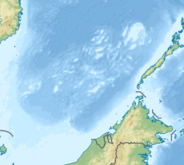
Lankiam Cay, also known as Panata Island (Filipino: Pulo ng Panata, lit. 'Island of Oath'; Mandarin Chinese: 楊信沙洲/杨信沙洲; pinyin: Yángxìn Shāzhōu; Vietnamese: đá An Nhơn), is the smallest of the naturally occurring Spratly Islands. It has an area of 0.44 hectares (1.1 acres) (4,400 sq. m), and is located about 7 nautical miles (13 km; 8.1 mi) east-northeast of Philippine-occupied Loaita (Kota) Island,[1] just west of the north of Dangerous Ground.[2] The island is administered by the Philippines as part of Kalayaan, Palawan, and is the eighth largest of the Philippine-occupied islands. It is also claimed by the People's Republic of China, the Republic of China (Taiwan), and Vietnam. EnvironmentAt one time the island had a surface area of more than 5 hectares (12 acres), but strong waves brought by a strong typhoon washed out the sandy surface (beach) of the island leaving behind the calcarenite foundation that can be seen at low tide. It has a wide lagoon. Philippine occupationThe island is guarded by soldiers stationed at nearby Loaita Island who regularly visit. It is kept under observation from a tall structure on Loaita Island. The location of this outpost, which the Philippines calls Panata Island, is often misreported as being on Lankiam Cay, to the east of Loaita Island. While reports suggest Lankiam was once a small sandy cay, it appears to have been washed away, leaving only a submerged reef and a small, shifting sand bar. If there was ever a Filipino facility there, it was moved to Loaita Cay and took the name “Panata Island” with it.[3] See alsoReferences
External links |
||||||||||||||||||||||||||||||||||||||||||


