Langezwaag

Langezwaag
Langsweagen
Village
Langezwaag church
Langezwaag church
Coat of arms of Langezwaag
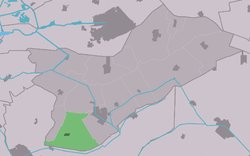
Location in Opsterland municipality
Langezwaag is located in Friesland
Langezwaag
Langezwaag
Location in the Netherlands
Langezwaag is located in Netherlands
Langezwaag
Langezwaag
Langezwaag (Netherlands)
Coordinates: 52°58′59″N 6°0′16″E / 52.98306°N 6.00444°E / 52.98306; 6.00444
CountryNetherlands Netherlands
ProvinceFriesland Friesland
MunicipalityOpsterland Opsterland
Area
 • Total
13.17 km2 (5.08 sq mi)
Elevation0.5 m (1.6 ft)
Population
 (2021)[1]
 • Total
1,050
 • Density80/km2 (210/sq mi)
Postal code
8404[1]
Dialing code0513

Langezwaag (West Frisian: Langsweagen) is a village in the municipality of Opsterland in the east of Friesland, the Netherlands. It had a population of around 1,365 in January 2017.[3]

History

The village was first mentioned in 1315 as Utresuagh, and means "long meadow with caddle". Lange (long) has been added to distinguish from Kortezwaag [nl].[4] Kortezwaag was annexed by Gorredijk in 1962 and is now a neighbourhood.[5] The Dutch Reformed church was built in 1781 as a replacement of a medieval church.

Langezwaag was home to 956 people in 1840.[6]

References

  1. ^ a b c "Kerncijfers wijken en buurten 2021". Central Bureau of Statistics. Retrieved 2 April 2022.
  2. ^ "Postcodetool for 8404BJ". Actueel Hoogtebestand Nederland (in Dutch). Het Waterschapshuis. Retrieved 2 April 2022.
  3. ^ Kerncijfers wijken en buurten 2017 - CBS Statline
  4. ^ "Langezwaag". Etymologiebank (in Dutch). Retrieved 2 April 2022.
  5. ^ "Kortezwaag". Plaatsengids (in Dutch). Retrieved 2 April 2022.
  6. ^ "Langezwaag". Plaatsengids (in Dutch). Retrieved 2 April 2022.

Media related to Langezwaag at Wikimedia Commons