Landusky, Montana

Landusky, Montana
Landusky is located in Montana
Landusky
Landusky
Landusky is located in the United States
Landusky
Landusky
Coordinates: 47°53′51″N 108°37′20″W / 47.89750°N 108.62222°W / 47.89750; -108.62222
CountryUnited States
StateMontana
CountyPhillips
Area
 • Total
0.09 sq mi (0.23 km2)
 • Land0.09 sq mi (0.23 km2)
 • Water0.00 sq mi (0.00 km2)
Elevation4,026 ft (1,227 m)
Population
 (2020)
 • Total
22
 • Density252.87/sq mi (97.54/km2)
Time zoneUTC-7 (Mountain (MST))
 • Summer (DST)UTC-6 (MDT)
ZIP Code
59546 (Zortman)
Area code406
FIPS code30-42325
GNIS feature ID2804314[2]

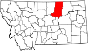
Landusky is an unincorporated community and census-designated place (CDP) in Phillips County, Montana, United States, with a population of 22 per the 2020 census. It is in the southwestern part of the county, in the southwestern part of the Little Rocky Mountains. It sits in the valley of Rock Creek, between Mill Gulch to the northeast and Montana Gulch to the northwest. Ore Street dead-ends in Landusky and leads southwest out of the Little Rockies 3.5 miles (5.6 km) to Montana Highway 66. The community is served by the Zortman post office, less than 5 miles (8 km) to the northeast across the Little Rockies but 21 miles (34 km) by road.

Landusky was first listed as a CDP prior to the 2020 census.[2]

Demographics

Historical population
CensusPop.Note
202022
U.S. Decennial Census[3]

References

  1. ^ "ArcGIS REST Services Directory". United States Census Bureau. Retrieved September 5, 2022.
  2. ^ a b c "Landusky Census Designated Place". Geographic Names Information System. United States Geological Survey, United States Department of the Interior.
  3. ^ "Census of Population and Housing". Census.gov. Retrieved June 4, 2016.