|
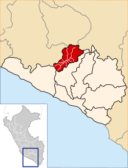
La Unión province, Peru
La Unión is a province of the Arequipa Region in Peru. Its seat is Cotahuasi. GeographyThe Huanzo mountain range traverses the province. One of the highest peaks of the province is Solimana at 6,093 metres (19,990 ft). Other mountains are listed below:[1]
Political divisionThe province is divided into eleven districts which are
Ethnic groupsThe people in the province are mainly indigenous citizens of Quechua descent. Quechua is the language which the majority of the population (59.18%) learnt to speak in childhood, 40.06% of the residents started speaking using the Spanish language (2007 Peru Census).[2] See alsoSources
External links
15°03′34″S 72°41′28″W / 15.059567°S 72.691083°W
|
||||||||||||||||||||||||||||||

