Krani

Krani
Крани
Kranjë
Village
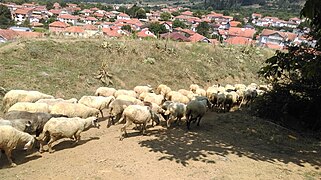
Panoramic view of the village Krani
Krani is located in North Macedonia
Krani
Krani
Location within North Macedonia
Coordinates: 40°56′22.73″N 21°6′29.26″E / 40.9396472°N 21.1081278°E / 40.9396472; 21.1081278
Country North Macedonia
Region Pelagonia
Municipality Resen
Population
 (2021)
 • Total
361
Time zoneUTC+1 (CET)
 • Summer (DST)UTC+2 (CEST)
Area code+389
Car platesRE

Krani (Macedonian: Крани; Albanian: Kranjë) is a village in the Resen Municipality in North Macedonia, roughly 19 kilometres (12 mi) south of the municipal centre of Resen.[1]

History

Krani has four known archaeological sites, two of which are from the Middle Ages, one from Late Antiquity, and one from the Hellenistic era. The latter was a fishing settlement and the two from the Middle Ages were churches.[2]

In 1905, Arvati's population consisted of 256 Bulgarian Exarchists and 342 Albanians. There was a Bulgarian school in the village.[3]

Demographics

Krani is inhabited by a Sunni Muslim Albanian majority and an Orthodox Macedonian minority.[4] A small number of Albanian speaking Muslim Romani used to live in Krani and during the latter decades of the 20th century have migrated to Ohrid and Resen.[4] In the late Ottoman period, some Bektashi Albanians, known locally as Kolonjarë, used to also reside in the village of Krani.[4] The national census in 2002 showed that Krani had 416 residents,[5] less than half of its 1961 population.[6]

Ethnic
group
census 1961 census 1971 census 1981 census 1991 census 1994 census 2002 census 2021
Number % Number % Number % Number % Number % Number % Number %
Macedonians 336 32.0 336 27.8 350 32.2 337 33.7 136 25.7 103 24.8 74 20.5
Albanians 711 67.7 867 71.8 709 65.2 639 63.8 373 70.5 305 73.3 263 72.9
Serbs 1 0.0 3 0.2 1 0.0 2 0.2 0 0.0 1 0.2 0 0.00
others 2 0.2 1 0.0 27 2.5 23 2.3 20 3.8 7 1.7 24 6.6
Total 1,050 1,207 1,087 1,001 529 416 361

The data on the mother tongues of Krani's residents, according to the 2002 census, is very similar to the ethnic makeup of the village with 311 declaring Albanian their mother tongue, followed by 104 declaring Macedonian, and one declaring Serbian.[7]

Panorama of Krani showing Lake Prespa to the west and beyond the mosque, Arvati village to far east

Religion

The main religions in the village are Islam and Orthodox Christianity, with 309 belonging to the former and 105 to the latter, as of the latest census. Additionally, two individuals declared Catholicism as their religion.[7] These figures suggest that the ethnic Macedonian population is Orthodox Christian, while the Albanian population is Muslim, as is the case nationally.

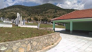
Krani has two churches, the Church of the Dormition of the Virgin Mary and the Church of St Nicholas.[8] It also has one mosque.[9]

People from Krani

References

  1. ^ "Krani". Retrieved 31 July 2013.
  2. ^ Koco, Dimče (1996). Археолошка карта на Република Македонија. Skopje: MANU. ISBN 9789989101069
  3. ^ D.M.Brancoff. "La Macédoine et sa Population Chrétienne". Paris, 1905, рр. 170-171.
  4. ^ a b c Sugarman, Jane (1997). Engendering song: Singing and subjectivity at Prespa Albanian weddings. University of Chicago Press. pp. 9–11. ISBN 9780226779720.
  5. ^ "Municipality of Resen". Archived from the original on 2018-08-31. Retrieved 2013-08-15.
  6. ^ Censuses of population 1948 – 2002 Archived 2013-10-14 at the Wayback Machine
  7. ^ a b "Macedonian census, language and religion" (PDF). Retrieved 2013-09-03.
  8. ^ Jelena Pavlovska, Наташа Ниќифоровиќ и Огнен Коцевски (2011). Valentina Božinovska (ed.). Карта на верски објекти во Македонија (in Macedonian). Menora – Skopje: Комисија за односи во верските заедници и религиозните групи. ISBN 978-608-65143-2-7.
  9. ^ "Karta na Verski Objekti vo Republika Makedonija" (PDF) (in Macedonian). Skopje: Komisija za odnosi so verskite zaednici i religiozni grupi. Archived from the original (PDF) on 24 January 2014. Retrieved 27 April 2014.
  10. ^ "Д-р Али Алиу". Macedonian Academy of Sciences and Arts. Archived from the original on 22 March 2014. Retrieved 22 March 2014.

40°56′N 21°07′E / 40.933°N 21.117°E / 40.933; 21.117