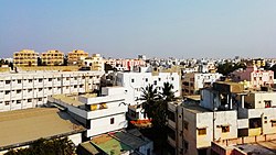
Kavali

Kavali
Kanakapatnam
Town
Kavali aerial view
Kavali aerial view
Kavali is located in Andhra Pradesh
Kavali
Kavali
Location in Andhra Pradesh, India
Coordinates: 14°54′47″N 79°59′35″E / 14.913001°N 79.992921°E / 14.913001; 79.992921
Country India
StateAndhra Pradesh
DistrictNellore district
Government
 • TypeMunicipal Council
 • BodyKavali Municipal Council
 • ChairmanVacant
 • Deputy ChairmanVacant
 • MLADAGUMATI VENKATA KRISHNA REDDY (TDP)
 • MPPRABHAKAR REDDY VEMIREDDY
Area
 • Total
22.95 km2 (8.86 sq mi)
Elevation20 m (70 ft)
Population
 (2011)[1]
 • Total
90,099
 • Rank4th (Towns in AP)
 • Density3,900/km2 (10,000/sq mi)
Languages
 • OfficialTelugu
Time zoneUTC+5:30 (IST)
PIN
524201,02,03
Vehicle registrationAP-39
Websitehttps://cdma.ap.gov.in/en/kavali-municipality

Kavali is a town[3][4] in Nellore district of Andhra Pradesh of India.[5][6] It also serves as headquarters of Kavali mandal and Kavali revenue division.It is one of the few cities from Andhra Pradesh which were selected for Atal Mission for Rejuvenation and Urban Transformation (AMRUT) Scheme.[7][8]

Etymology

In Telugu, kāvali means protection/security. The name arises from the fact that in 1515, the king of Udayagiri, Harihara Rayulu stationed his army at this town.[9]

Geography

Kavali is located at 14°54′47″N 79°59′35″E / 14.913001°N 79.992921°E / 14.913001; 79.992921. It has an average elevation of 17 metres (56 ft). The town is at a distance of 8 km from the Bay of Bengal.

Demographics

As of the 2011 Census of India, the town had a population of 90,099. The total population is 75,206 males, 75,127 females and children (in the age group of 0–6 years). The average literacy rate stands at 81.09% with 60,497 literates, significantly higher than the national average of 73.00%.[10]

Governance

Civic administration

Kavali Municipal Council is the seat of local government which administers Kavali town.

Education

As per the school information report for the academic year 2018–19, the town has a total of 57 schools. These include 34 private, 2 ZPHS and 21 municipal schools.[11]

VSU PG Study centre and JB college is located in Kavali. 3 engineering colleges are present in the town.

Climate

Climate data for Kavali (1995–2020, extremes 1995–2020)
Month Jan Feb Mar Apr May Jun Jul Aug Sep Oct Nov Dec Year
Record high °C (°F) 34.5
(94.1)
38.2
(100.8)
40.8
(105.4)
44.3
(111.7)
47.2
(117.0)
45.2
(113.4)
41.0
(105.8)
39.5
(103.1)
40.1
(104.2)
38.6
(101.5)
36.3
(97.3)
34.0
(93.2)
47.2
(117.0)
Mean daily maximum °C (°F) 29.8
(85.6)
31.6
(88.9)
34.2
(93.6)
36.5
(97.7)
39.4
(102.9)
37.8
(100.0)
35.6
(96.1)
34.9
(94.8)
34.5
(94.1)
32.7
(90.9)
30.7
(87.3)
29.5
(85.1)
33.9
(93.0)
Mean daily minimum °C (°F) 20.5
(68.9)
21.7
(71.1)
23.9
(75.0)
26.3
(79.3)
28.4
(83.1)
28.3
(82.9)
27.0
(80.6)
26.5
(79.7)
26.0
(78.8)
25.0
(77.0)
23.1
(73.6)
21.2
(70.2)
24.8
(76.6)
Record low °C (°F) 16.2
(61.2)
16.6
(61.9)
19.0
(66.2)
20.4
(68.7)
21.6
(70.9)
21.3
(70.3)
21.3
(70.3)
22.3
(72.1)
21.8
(71.2)
19.5
(67.1)
18.0
(64.4)
17.0
(62.6)
16.2
(61.2)
Average rainfall mm (inches) 34.9
(1.37)
21.1
(0.83)
6.2
(0.24)
13.4
(0.53)
56.1
(2.21)
56.0
(2.20)
77.0
(3.03)
100.0
(3.94)
113.1
(4.45)
300.0
(11.81)
284.2
(11.19)
82.3
(3.24)
1,144.2
(45.05)
Average rainy days 1.0 0.9 0.3 0.7 1.6 3.8 5.3 6.6 6.4 8.8 8.3 3.5 47.1
Average relative humidity (%) (at 17:30 IST) 68 65 66 68 56 48 53 55 62 70 72 71 63
Source: India Meteorological Department[12][13][14]

Transport

Roadways

National Highway 16, a part of Golden Quadrilateral highway network, bypasses the town.[15] National Highway 167BG which starts at National Highway 167B near Seetharamapuram village in Nellore district ends at kavali.[16]

Railways

Kavali railway station

Kavali railway station is located on the Howrah–Chennai main line. It is classified as a B–category station in the Vijayawada railway division of South Central Railway zone.[17] The Andhra Pradesh State Road Transport Corporation operates bus services from Kavali bus station.[18] The nearest planned upcoming sea port is Ramayapatnam port which is at a distance of 20 km from the town.[19][20][21]

Air

The nearest airport is under construction at Damavaram which is 30  km from the town.[22][23]

See also

References

  1. ^ a b "Statistical Information of ULBs and UDAs" (PDF). Directorate of Town and Country Planning. Government of Andhra Pradesh. 27 February 2019. p. 3. Retrieved 20 May 2019.
  2. ^ "Elevation for Rajam". Veloroutes. Retrieved 21 August 2014.
  3. ^ "ALPHABETICAL LIST OF TOWNS AND THEIR POPULATION" (PDF).
  4. ^ "Cities having population 1 lakh and above, Census 2011" (PDF).
  5. ^ "Definition of Towns, Urban Agglomerations and Tier Cities in India". GKToday. Retrieved 27 March 2020.
  6. ^ "Cities and Towns - Arthapedia". arthapedia.in. Retrieved 27 March 2020.
  7. ^ "Amaravati included in AMRUT scheme". The Hindu. 24 October 2015. ISSN 0971-751X. Retrieved 27 March 2020.
  8. ^ "Smart Cities Council India | Siddipet, Kavali selected for AMRUT Cities". india.smartcitiescouncil.com. Retrieved 27 March 2020.
  9. ^ 'kāvali' as a Telugu word, 1416; p.132. "A Dravidian Etymological Dictionary (1961)".{{cite web}}: CS1 maint: multiple names: authors list (link) CS1 maint: numeric names: authors list (link)
  10. ^ "Chapter–3 (Literates and Literacy rate)" (PDF). Registrar General and Census Commissioner of India. Retrieved 20 August 2014.
  11. ^ "School Information". Commissionerate of School Education. Government of Andhra Pradesh. Archived from the original on 16 April 2019. Retrieved 7 May 2019.
  12. ^ "Climatological Tables of Observatories in India 1991-2020" (PDF). India Meteorological Department. Retrieved 8 April 2024.
  13. ^ "Station: Kavali Climatological Table 1981–2010" (PDF). Climatological Normals 1981–2010. India Meteorological Department. January 2015. pp. 403–404. Archived from the original (PDF) on 5 February 2020. Retrieved 18 February 2020.
  14. ^ "Extremes of Temperature & Rainfall for Indian Stations (Up to 2012)" (PDF). India Meteorological Department. December 2016. p. M10. Archived from the original (PDF) on 5 February 2020. Retrieved 18 February 2020.
  15. ^ "National Highways Development Project Map". National Highways Authority of India. Archived from the original on 22 April 2017. Retrieved 21 April 2017.
  16. ^ "New national highways declaration notification" (PDF). The Gazette of India - Ministry of Road Transport and Highways. Retrieved 24 March 2019.
  17. ^ "Vijayawada Division – a profile" (PDF). Indian Railways. Retrieved 13 February 2013.
  18. ^ "Bus Stations in Districts". Andhra Pradesh State Road Transport Corporation. Archived from the original on 22 March 2016. Retrieved 9 March 2016.
  19. ^ "Ramayapatnam port may materialise soon, Andhra government approves establishment proposal". The New Indian Express. Retrieved 27 March 2020.
  20. ^ "Andhra Pradesh government proposes seaport worth Rs 10k cr at Ramayapatnam". The Economic Times. 25 December 2019. Retrieved 27 March 2020.
  21. ^ Special Correspondent (13 February 2020). "Parties speak in one voice on Ramayapatnam port project". The Hindu. ISSN 0971-751X. Retrieved 27 March 2020. {{cite news}}: |author= has generic name (help)
  22. ^ "Airports Authority of India to develop greenfield airport in Nellore". The New Indian Express. Retrieved 27 March 2020.
  23. ^ India, The Hans (11 January 2019). "Dagadarthi airport will be ready in 14 months". The Hans Indian. Retrieved 27 March 2020.