|
Jack Knife Fire
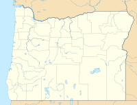
The Jack Knife Fire was a wildfire five miles north of Kent, Oregon in the United States. The fire was started by lightning on June 20, 2018, around 3:00 pm, just west of the John Day River. The fire burned 15,676 acres (63 km2). EventsThe Jack Knife fire was started on June 20, 2018, by a lightning strike, along the John Day River, five miles north of Kent, Oregon. The fire was one of 70 wildfires started in Oregon due to lightning strikes over a two-day period. By June 23, the fire had spread to 2,000 acres (8 km2), moving along the river and north to Wilson Point and south to Adobe Point.[2] By June 26, the fire had grown to 15,676 acres (63 km2) as the result of hot and dry weather. It was contained on July 6.[1] References
|
||||||||||||||||||

