Ilhéu Grande

Ilhéu Grande
Ilhéu Grande is located in Cape Verde
Ilhéu Grande
Ilhéu Grande
Ilhéu Grande is located in Atlantic Ocean
Ilhéu Grande
Ilhéu Grande
Geography
LocationAtlantic Ocean
Coordinates14°57′54″N 24°41′56″W / 14.965°N 24.699°W / 14.965; -24.699
Area3 km2 (1.2 sq mi)
Length2.3 km (1.43 mi)
Width1.1 km (0.68 mi)
Highest elevation96 m (315 ft)
Administration
Demographics
Population0

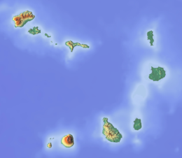
Ilhéu Grande is an uninhabited island of Cape Verde. It is the largest of the Ilhéus do Rombo islet group, located 4 km (2 mi) west of Ilhéu de Cima, the other main islet of the group, and 7 km (4 mi) north of the island Brava. Its length is 2.3 km (1.4 mi) from southwest to northeast and the width is approximately 1.1 km (0.7 mi) from southeast to northwest. It is 96 m high.[1] The islet forms a part of the integral nature reserve Ilhéus do Rombo.[2]

View of Ilhéus do Rombo from the middle of Brava in Nova Sintra, Ilhéu Grande is on the left

The islet is a volcanic seamount and has a rocky coastline. It is mostly barren but has some scattered vegetation.[3] Large bird colonies must have existed formerly as the island has thick layers of guano. It has been used by goat farmers and whalers in the past. The islet was mentioned as "Juan Carnira" in the 1747 map by Jacques-Nicolas Bellin.[4]

References

  1. ^ Sailing Directions (Enroute), Pub. 143: West Coast of Europe and Northwest Africa (PDF). Sailing Directions. United States National Geospatial-Intelligence Agency. 2017. p. 247.
  2. ^ Nature reserves of Cape Verde
  3. ^ "Ilhéus do Rombo". Sites - Important Bird Areas. BirdLife International. Retrieved 6 August 2018.
  4. ^ Jacques-Nicolas Bellin (1747). "Carte des Isles du Cap Verd = Kaart van de Eilanden van Kabo Verde" (in French).