|
Ibaraki, Ibaraki
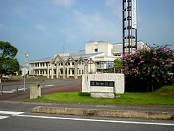
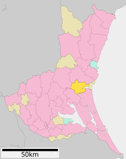
 Ibaraki (茨城町, Ibaraki-machi) is a town located in Ibaraki Prefecture, Japan. As of 1 July 2020[update], the town had an estimated population of 31,596 in 12,052 households and a population density of 260 inhabitants per square kilometre (670/sq mi). The percentage of the population aged over 65 was 34.9%.[1] The total area of the town is 121.58 square kilometres (46.94 sq mi). GeographyLocated in central Ibaraki Prefecture, south of prefectural capital of Mito, Ibaraki is located in the flatlands near the Pacific Ocean, and almost encompasses Lake Hinuma, the 30th largest body of freshwater in Japan. Surrounding municipalitiesClimateIbaraki has a humid continental climate (Köppen Cfa) characterized by warm summers and cold winters with light snowfall. The average annual temperature in Ibaraki is 13.9 °C. The average annual rainfall is 1367 mm with September as the wettest month. The temperatures are highest on average in August, at around 25.7 °C, and lowest in January, at around 3.1 °C.[2] DemographicsPer Japanese census data,[3] the population of Ibaraki has remained relatively steadily for the past 40 years.
HistoryThe villages of Nagaoka, Kawane, Kaminoai and Ishizaki were created within Higashiibaraki District and the village of Numasaki was created within Kashima District with the establishment of the modern municipalities system on April 1, 1889. Nagaoka was elevated to town status on February 11, 1955 and merged with Kawane and Kaminoai to form the town of Ibaraki the same day. Ibaraki annexed neighboring Ishizaki on March 5, 1958. The town was set to merge with Mito, on December 8, 2007, but following the election of a new mayor in April 2007, these plans were abandoned. GovernmentIbaraki has a mayor-council form of government with a directly elected mayor and a unicameral town council of 16 members. Ibaraki, together with neighboring Hokota and Ōarai, contributes two members to the Ibaraki Prefectural Assembly. In terms of national politics, the town is part of Ibaraki 2nd district of the lower house of the Diet of Japan. EconomyThe economy of Ibaraki is primarily agricultural. Education
TransportationRailway
Highway
Local attractions
Noted people from Ibaraki
References
External links
|
|||||||||||||||||||||||||||||||||||||||||||||||||||||||||||||||||||||||||


