Gediz Delta

Gediz Delta
An overexposed image of a marsh, with calm flat waters in every direction, peppered with small islands of grass. The sky is bleeding over the rest of the image, and some hills can be seen in the distance, not fully obscured by the glare.
The Gediz River Delta on a bright afternoon.
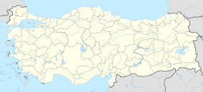
Map showing the location of Gediz Delta
Locationİzmir Province, Turkey
Nearest cityİzmir
Coordinates38°31′N 26°53′E / 38.517°N 26.883°E / 38.517; 26.883
Area14,900 ha (58 sq mi)
Governing bodyMinistry of Agriculture and Forestry
Official nameGediz Delta
Designated15 April 1998
Reference no.945[1]

The Gediz Delta is the river delta at the confluence of the Gediz River with the Gulf of İzmir, in İzmir Province in western Turkey. It is a 14,900 ha area of land that occupies coastal parts of Foça, Menemen, and Çiğli districts.[2] It is one of the largest areas of coastal wetlands in Turkey and has a biodiversity of plants and birds.[2] It is a Ramsar site since 1998 and an Important Bird Area since 2000.[1][3] It is 26 km from İzmir city center.[2]

Flora and fauna

The delta is home to more than 250 bird species and hosts approximately 80,000 birds in winter.[2] It provides shelter for 10% of the world's flamingo population.[4]

History

Remains of the former Ionian town of Leucae is located on the delta.[2]

Economy

Çamaltı Salt Pan, which is located on the delta, provides one third of Turkey's salt production.[2]

References

  1. ^ a b "Gediz Delta". Ramsar Sites Information Service. Archived from the original on 27 February 2017. Retrieved 16 May 2020.
  2. ^ a b c d e f "Information Sheet on Ramsar Wetlands" (PDF). Ramsar Sites Information Service. Retrieved 16 May 2020.
  3. ^ "Gediz Delta". BirdLife International. Retrieved 16 May 2020.
  4. ^ "Gediz Deltası" (in Turkish). Doğa Derneği. 4 September 2015. Retrieved 16 May 2020.

Further reading