Flaugnac

Flaugnac
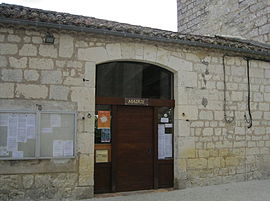
The town hall in Flaugnac
Location of Flaugnac
Map
Flaugnac is located in France
Flaugnac
Flaugnac
Flaugnac is located in Occitanie
Flaugnac
Flaugnac
Coordinates: 44°16′44″N 1°23′40″E / 44.2789°N 1.3944°E / 44.2789; 1.3944
CountryFrance
RegionOccitania
DepartmentLot
ArrondissementCahors
CantonMarches du Sud-Quercy
CommuneSaint-Paul-Flaugnac
Area
1
30.96 km2 (11.95 sq mi)
Population
 (2019)[1]
410
 • Density13/km2 (34/sq mi)
Time zoneUTC+01:00 (CET)
 • Summer (DST)UTC+02:00 (CEST)
Postal code
46170
Elevation143–299 m (469–981 ft)
(avg. 244 m or 801 ft)
1 French Land Register data, which excludes lakes, ponds, glaciers > 1 km2 (0.386 sq mi or 247 acres) and river estuaries.

Flaugnac (French pronunciation: [floɲak]; Languedocien: Flaunhac) is a former commune in the Lot department in south-western France. On 1 January 2016, it was merged into the new commune of Saint-Paul-Flaugnac.[2]

Geography

The Barguelonne forms most of the commune's northwestern border.

See also

References