|
Dindigul district
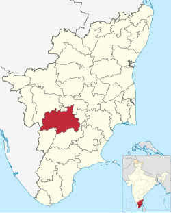
Dindigul District is one of the 38 districts in the state of Tamil Nadu in India. Dindigul District is the largest district in Tamil Nadu by area. The district was carved out of Madurai District in 1985. It has an area of 6266.64 km2 and comprises 3 revenue divisions, 10 taluks, and 14 panchayat unions. The district is located in Southwest of Tamil Nadu. The district is bound by Madurai district in the south,Tiruppur district in the northwest, Karur district in the north, Tiruchirappalli district in the northeast, Theni district in the Southwest and Idukki district of Kerala to the west. As of 2011, the district had a population of 2,159,775 with a sex-ratio of 998 females for every 1,000 males. EconomyIn 2006, the Ministry of Panchayati Raj named Dindigul one of the country's 250 most backward districts (out of a total of 640).[4] It is one of the six districts in Tamil Nadu currently receiving funds from Backward Regions Grant Fund Programme (BRGF). The district is struck between the north south chaos as it lies in the center of Tamil Nadu. Its relative closeness to the cities of Trichy, Tiruppur, Karur, coimbatore, Madurai makes this district as a Transport nexus of this region. Geography and ClimateThe western part of the district which includes constituencies Palani and Oddanchatram lies in the Coimbatore plateau which is made up of red soil(except in some places), while the rest of the district is relatively plain and has black and loamy soil. And the regions of Oddanchatram, Vedasandhur are semi-arid, due to the rain shadow effect of Western Ghats, Sirumalai and Karandhamalai. The different food, culture and settlement is attributed to this geographical contrast. Oddanchatram and Palani are open to the Coimbatore plateau which contributes to their kongu population. And their economy is much more oriented towards the kongu belt of coimbatore Tiruppur and Erode while it peers like Dindigul,Arthur and Natham is more dependent on Madurai both culturally and Economically. Demographics
According to the 2011 census, Dindigul district had a population of 2,159,775 with a sex-ratio of 998 females for every 1,000 males, much above the national average of 929. 37.41% of the population lived in urban areas.[7] A total of 216,576 were under the age of six, constituting 111,955 males and 104,621 females. Scheduled Castes and Scheduled Tribes accounted for 20.95% and 0.37% of the population, respectively. The average literacy of the district was 68.61%, compared to the national average of 72.99%.[7] The district had a total of 560,773 households. There were a total of 1,105,155 workers, comprising 155,332 cultivators, 388,725 main agricultural labourers, 25,253 in house hold industries, 393,707 other workers, 142,138 marginal workers, 10,073 marginal cultivators, 79,234 marginal agricultural labourers, 5,576 marginal workers in household industries and 47,255 other marginal workers.[7] At the time of the 2011 census, 91.52% of the population spoke Tamil, 5.45% Telugu and 1.69% Kannada as their first language.[8] Politics
Dindigul district has been internally divided by culture and politics with the west like oddanchatram and Palani which have different kongu culture. And the east have different culture . Places of interest
See alsoReferences
External linksWikimedia Commons has media related to Dindigul district. |
||||||||||||||||||||||||||||||||||||||||||||||||||||||||||||||||||||||||||||||||||||||||||||||||||||||||||||||||||||||||||||||||||||||||||||||||||||||||||||||||||||||||||||


