Unincorporated community in Indiana, United States
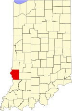
Curryville is an unincorporated community in Curry Township, Sullivan County, in the U.S. state of Indiana.[2]
The community is part of the Terre Haute Metropolitan Statistical Area.
History
A post office was established at Curryville in 1840, and remained in operation until it was discontinued in 1861.[3]
Sullivan County's first underground coal mine was opened in Curryville, on farmland belonging to Indiana Supreme Court justice, James Hanna.[4]
Geography
Curryville is located at 39°11′13″N 87°23′33″W / 39.18694°N 87.39250°W / 39.18694; -87.39250.
References
- ^ "US Board on Geographic Names". United States Geological Survey. October 25, 2007. Retrieved August 30, 2016.
- ^ "Curryville, Sullivan County, Indiana". Geographic Names Information System. United States Geological Survey. Retrieved August 5, 2017.
- ^ "Sullivan County". Jim Forte Postal History. Retrieved August 30, 2016.
- ^ Minde C. Browning, Richard Humphrey, and Bruce Kleinschmidt, "Biographical Sketches of Indiana Supreme Court Justices", Indiana Law Review, Vol. 30, No. 1 (1997), section reproduced in Indiana Courts Justice Biographies page.


