|
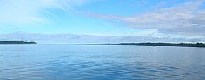
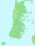
Chacao Channel The Chacao Channel (Spanish: Canal de Chacao) is located in Los Lagos Region, Chile and separates Chiloé Island from mainland Chile. The channel is about 40 km long and 4 km wide and connects the Pacific Ocean and Gulf of Ancud.[1] The channel was created during the Quaternary glaciations by successive glaciers that flowed down from the Andes to the coast.[citation needed] The construction of a bridge connecting the island with the continent was discussed at government level for some time, but during the first government of Michelle Bachelet (2006–2010) it was turned down due to its high cost in comparison with other proposals that could be done to benefit islanders. Later, it was reactivated during Sebastián Piñera government, and finally auctioned. Construction started in 2017 and expected to be completed in 2028. A single-circuit 220 kV-powerline with a span-length of 2682 metres crosses the Chacao Channel, built in 1995. The towers of each end of this span are 179 metres tall.[2] The horizontal speed of tides in the channel has been measured to reach a maximum between 4 and 5 m/s during flood and 3 to 4 m/s during ebb.[3] The channel has a high tidal energy potential.[3][4] About 700 m from the southern bank of the channel is a rocky promontory known as Roca Remolinos in the channel.[1] Its top can occasionally be seen during very low tides.[5] About 1500 m southeast of Roca Remolinos is a 20 m deep bank known as Seluian Bank.[1] See alsoReferences
|


