Carlisle County, Kentucky

Carlisle County
Carlisle County Courthouse
Map of Kentucky highlighting Carlisle County
Location within the U.S. state of Kentucky
Map of the United States highlighting Kentucky
Kentucky's location within the U.S.
Coordinates: 36°51′N 88°59′W / 36.85°N 88.98°W / 36.85; -88.98
Country United States
State Kentucky
Founded1886
Named forJohn G. Carlisle
SeatBardwell
Largest cityBardwell
Area
 • Total199 sq mi (520 km2)
 • Land189 sq mi (490 km2)
 • Water9.5 sq mi (25 km2)  4.8%
Population
 (2020)
 • Total4,826
 • Estimate 
(2023)
4,704 Decrease
 • Density24/sq mi (9.4/km2)
Time zoneUTC−6 (Central)
 • Summer (DST)UTC−5 (CDT)
Congressional district1st
Websitecarlislecounty.ky.gov

Carlisle County is a county located in the U.S. state of Kentucky. As of the 2020 census, the population was 4,826, making it the fourth-least populous county in Kentucky. Its county seat is Bardwell.[1] The county was founded in 1886 and named for John Griffin Carlisle, a Speaker of the United States House of Representatives from Kentucky.[2] It remains a prohibition or dry county. Carlisle County is included in the Paducah, KY-IL, Metropolitan Statistical Area.

Geography

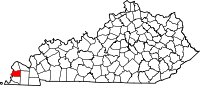
According to the U.S. Census Bureau, the county has a total area of 199 square miles (520 km2), of which 189 square miles (490 km2) is land and 9.5 square miles (25 km2) (4.8%) is water.[3] The county's western border with Missouri is formed by the Mississippi River.

Adjacent counties

Demographics

Historical population
CensusPop.Note
18907,612
190010,19533.9%
19109,048−11.3%
19208,231−9.0%
19307,363−10.5%
19407,6503.9%
19506,206−18.9%
19605,608−9.6%
19705,354−4.5%
19805,4872.5%
19905,238−4.5%
20005,3512.2%
20105,104−4.6%
20204,826−5.4%
2023 (est.)4,704[4]−2.5%
U.S. Decennial Census[5]
1790-1960[6] 1900-1990[7]
1990-2000[8] 2020-2021[9]

As of the census[10] of 2000, there were 5,351 people, 2,208 households, and 1,574 families residing in the county. The population density was 28 per square mile (11/km2). There were 2,490 housing units at an average density of 13 per square mile (5.0/km2). The racial makeup of the county was 97.78% White, 0.95% Black or African American, 0.41% Native American, 0.07% Asian, 0.22% from other races, and 0.56% from two or more races. 0.82% of the population were Hispanic or Latino of any race.

There were 2,208 households, out of which 30.60% had children under the age of 18 living with them, 58.50% were married couples living together, 9.30% had a female householder with no husband present, and 28.70% were non-families. 26.30% of all households were made up of individuals, and 13.10% had someone living alone who was 65 years of age or older. The average household size was 2.40 and the average family size was 2.88.

In the county, the population was spread out, with 23.40% under the age of 18, 7.80% from 18 to 24, 26.40% from 25 to 44, 24.10% from 45 to 64, and 18.30% who were 65 years of age or older. The median age was 40 years. For every 100 females there were 95.20 males. For every 100 females age 18 and over, there were 92.90 males.

The median income for a household in the county was $30,087, and the median income for a family was $33,433. Males had a median income of $29,523 versus $19,792 for females. The per capita income for the county was $16,276. About 10.50% of families and 13.10% of the population were below the poverty line, including 17.40% of those under age 18 and 11.00% of those age 65 or over.

Politics

United States presidential election results for Carlisle County, Kentucky[11]
Year Republican Democratic Third party(ies)
No.  % No.  % No.  %
2020 2,159 81.84% 463 17.55% 16 0.61%
2016 2,094 80.51% 432 16.61% 75 2.88%
2012 1,835 70.06% 750 28.64% 34 1.30%
2008 1,699 64.92% 879 33.59% 39 1.49%
2004 1,734 60.95% 1,102 38.73% 9 0.32%
2000 1,405 54.18% 1,149 44.31% 39 1.50%
1996 816 33.62% 1,355 55.83% 256 10.55%
1992 844 33.16% 1,383 54.34% 318 12.50%
1988 1,104 43.06% 1,428 55.69% 32 1.25%
1984 1,308 50.15% 1,277 48.96% 23 0.88%
1980 975 38.31% 1,542 60.59% 28 1.10%
1976 435 17.71% 1,985 80.82% 36 1.47%
1972 1,169 55.75% 872 41.58% 56 2.67%
1968 479 19.65% 1,144 46.92% 815 33.43%
1964 282 15.22% 1,565 84.46% 6 0.32%
1960 978 35.59% 1,770 64.41% 0 0.00%
1956 608 22.72% 2,063 77.09% 5 0.19%
1952 656 25.99% 1,867 73.97% 1 0.04%
1948 279 12.57% 1,899 85.54% 42 1.89%
1944 505 19.67% 2,057 80.10% 6 0.23%
1940 500 17.37% 2,366 82.21% 12 0.42%
1936 420 16.15% 2,150 82.69% 30 1.15%
1932 402 12.36% 2,840 87.30% 11 0.34%
1928 787 28.28% 1,994 71.65% 2 0.07%
1924 467 16.93% 2,250 81.58% 41 1.49%
1920 688 19.99% 2,688 78.09% 66 1.92%
1916 494 22.61% 1,646 75.33% 45 2.06%
1912 331 17.04% 1,409 72.55% 202 10.40%

Communities

Cities

Unincorporated communities

See also

36°51′N 88°59′W / 36.85°N 88.98°W / 36.85; -88.98

References

  1. ^ "Find a County". National Association of Counties. Archived from the original on May 31, 2011. Retrieved June 7, 2011.
  2. ^ The Register of the Kentucky State Historical Society, Volume 1. Kentucky State Historical Society. 1903. pp. 34.
  3. ^ "2010 Census Gazetteer Files". United States Census Bureau. August 22, 2012. Archived from the original on August 12, 2014. Retrieved August 13, 2014.
  4. ^ "Annual Estimates of the Resident Population for Counties: April 1, 2020 to July 1, 2022". United States Census Bureau. Retrieved April 2, 2023.
  5. ^ "U.S. Decennial Census". United States Census Bureau. Retrieved August 13, 2014.
  6. ^ "Historical Census Browser". University of Virginia Library. Retrieved August 13, 2014.
  7. ^ "Population of Counties by Decennial Census: 1900 to 1990". United States Census Bureau. Retrieved August 13, 2014.
  8. ^ "Census 2000 PHC-T-4. Ranking Tables for Counties: 1990 and 2000" (PDF). United States Census Bureau. Archived (PDF) from the original on March 27, 2010. Retrieved August 13, 2014.
  9. ^ "2020 Census Data". data.census.gov.
  10. ^ "U.S. Census website". United States Census Bureau. Retrieved January 31, 2008.
  11. ^ Leip, David. "Dave Leip's Atlas of U.S. Presidential Elections". uselectionatlas.org. Retrieved June 30, 2018.

Read other articles:

В Википедии есть статьи о других людях с фамилией Путята. Владимир Путята Архиепископ Пензенский и Саранский 10 января 1915 — 2 августа 1917 Предшественник Митрофан (Симашкевич) Преемник Феодор (Лебедев) Архиепископ Донской и Новочеркасский 11 июля 1914 — 10 января 1915 Пр…

This article is about the party founded in 1971. For the party founded in 1904 by James Connolly, see Socialist Party of Ireland (1904). For the current Socialist Party in Ireland, see Socialist Party (Ireland). Political party in the Republic of Ireland Socialist Party of Ireland Founded1971 (1971)Dissolved1982 (1982)NewspaperVanguardIdeologyMarxist-Leninism EurocommunismPolitical positionFar LeftPolitics of the Republic of IrelandPolitical partiesElections The Socialist Part…

Form of autonomous proto-anarchist society This article includes a list of general references, but it lacks sufficient corresponding inline citations. Please help to improve this article by introducing more precise citations. (March 2022) (Learn how and when to remove this message) Autographed title page of Wilson's Pirate Utopias Part of a series onUtopias Mythical and religious Arcadia City of the Caesars Cloud cuckoo land Cockaigne Eden Elysium Fortunate Isles Garden of the gods Shangri-La Go…

Lembah Hanzhong. Negara Wu Dou Mi Dao pernah berdiri di tempat ini. Wǔ Dǒu Mǐ Dào (Hanzi: 五斗米道, secara harfiah berarti Jalan Lima Gantang Beras) adalah sebuah gerakan Taois di Tiongkok yang didirikan oleh Guru Langit Zhang Daoling pada tahun 142 M.[1] Pada puncaknya, gerakan ini telah membentuk sebuah negara teokratik di Lembah Hanzhong (sebelah utara Sichuan). Pada tahun 215 M, negeri ini dikuasai oleh Kerajaan Wei yang dipimpin Cao Cao, dan para pengikut Guru Langit pun…

Study of the doctrines of the Catholic Church For broader coverage of this topic, see Christian theology. Part of a series on theCatholic ChurchSt. Peter's Basilica, Vatican City Overview Pope: Francis Hierarchy History (timeline) Theology Liturgy Sacraments Mary Background Jesus Crucifixion Resurrection Ascension Early Christianity Peter Paul Fathers History of the Catholic Church History of the papacy Ecumenical councils Magisterium Four Marks of the Church One true church Apostolic succession…

Drainage basin of the Columbia River in western North America The Columbia Basin The Columbia River drainage basin is the drainage basin of the Columbia River in the Pacific Northwest region of North America. It covers 668,000 km2 or 258,000 sq mi.[1] In common usage, the term often refers to a smaller area, generally the portion of the drainage basin that lies within eastern Washington.[1] Usage of the term Columbia Basin in British Columbia generally refers only …

222.ª Brigada MixtaActiva Verano de 1937 - marzo de 1939País EspañaFidelidad República EspañolaRama/s Ejército Popular RegularTipo InfanteríaTamaño Brigada MixtaGuerras y batallas Guerra Civil Española[editar datos en Wikidata] La 222.ª Brigada Mixta fue una de las Brigadas Mixtas creadas por el Ejército Popular para la defensa de la Segunda República Española durante la Guerra Civil Española. La unidad fue organizada con batallones del Cuerpo de Carabineros. Historial La…

هذه المقالة يتيمة إذ تصل إليها مقالات أخرى قليلة جدًا. فضلًا، ساعد بإضافة وصلة إليها في مقالات متعلقة بها. (نوفمبر 2021) أكاديمية أوديسا الوطنية للموسيقى   معلومات التأسيس 1913  الموقع الجغرافي إحداثيات 46°28′59″N 30°43′30″E / 46.4831°N 30.7251°E / 46.4831; 30.7251   المكان أوديس…

American digital multicast television network This article is about the American television network. For the British television channel, see Quest (British TV channel). Television channel QuestTypeDigital multicast television networkCountryUnited StatesBroadcast areaNationwide via OTA digital televisionAffiliatesList of affiliatesHeadquartersAtlanta, GeorgiaProgrammingPicture format480i (SDTV)OwnershipOwnerTegna Inc.Key peopleBrian Weiss (President / General Manager)John Ford (Head of Programmin…

阿塔莱亚Ataléia市镇阿塔莱亚在巴西的位置坐标:18°02′38″S 41°06′36″W / 18.0439°S 41.11°W / -18.0439; -41.11国家巴西州米纳斯吉拉斯州面积 • 总计1,838.384 平方公里(709.804 平方英里)人口 • 總計15,078人 • 密度8.2人/平方公里(21.2人/平方英里) 阿塔莱亚(葡萄牙语:Ataléia)是巴西米纳斯吉拉斯州的一个市镇。总面积1838.384平方公…

German footballer (born 1988) You can help expand this article with text translated from the corresponding article in German. (March 2022) Click [show] for important translation instructions. View a machine-translated version of the German article. Machine translation, like DeepL or Google Translate, is a useful starting point for translations, but translators must revise errors as necessary and confirm that the translation is accurate, rather than simply copy-pasting machine-translated tex…

Super HeroLagu oleh VIXXSisi-BStarlightDirilis24 Mei 2012 (2012-05-24)FormatCD, unduhan digitalDirekam2012GenreK-pop, Dance-popDurasi3:30LabelJellyfish EntertainmentPenciptaKiggen, RaviProduserKiggen, Brent Paschke, Jimmy Richard Drew Super Hero adalah album singel debut dari boy band asal Korea Selatan, VIXX, yang dirilis pada 24 Mei 2012 oleh Jellyfish Entertainment. Super Hero ditulis dan disusun oleh Lee Ki Won (Kiggen), leader dari trio hip hop Phantom. Ravi juga ikut berpatisipasi den…

Cyperus fuscus Klasifikasi ilmiah Kerajaan: Plantae (tanpa takson): Tracheophyta (tanpa takson): Angiospermae (tanpa takson): Monokotil (tanpa takson): Komelinid Ordo: Poales Famili: Cyperaceae Genus: Cyperus Spesies: Cyperus fuscus Nama binomial Cyperus fuscusL. Cyperus fuscus adalah spesies tumbuhan yang tergolong ke dalam famili Cyperaceae. Spesies ini juga merupakan bagian dari ordo Poales. Spesies Cyperus fuscus sendiri merupakan bagian dari genus Cyperus.[1] Nama ilmiah dari spesie…

Halaman ini berisi artikel tentang monarki Saint Lucia. Untuk informasi tentang negara lainnya yang berbagi orang yang sama sebagai penguasa monarki, lihat Wilayah Persemakmuran. Raja Saint LuciaKing of Saint Luciacode: en is deprecated   (Inggris)Sedang berkuasaCharles IIIsejak 8 September 2022 PerincianPewarisWilliam, Pangeran WalesPenguasa pertamaElizabeth IIPembentukan22 Februari 1979 Templat:Politik Saint Lucia Monarki Saint Lucia adalah sebuah sistem pemerintahan dimana peng…

RomancioRumantschParlato in Svizzera Regioni Grigioni LocutoriTotale41 519 (Censimento 2009)[1] TassonomiaFilogenesiLingue indoeuropee Lingue italiche  Lingue romanze   Lingue italo-occidentali    Lingue romanze occidentali     Lingue gallo-iberiche      Lingue galloromanze       Lingue gallo-retiche      …

U.S. college athletic conference Mountain East redirects here. Not to be confused with East Mountain or Eastmont (disambiguation). Mountain East ConferenceAssociationNCAAFounded2012CommissionerReid Amos (since 2012)Sports fielded 23 men's: 11 women's: 12 DivisionDivision IINo. of teams11HeadquartersBridgeport, West VirginiaRegionWest Virginia, Maryland, and PennsylvaniaOfficial websitewww.mountaineast.orgLocations The Mountain East Conference (MEC) is a college athletic conference affiliated wit…

Амр ибн аль-Асараб. عمرو بن العاص‎ Наместник Египта 661 — 664 Предшественник Мухаммад ибн Абу Бакр Личная информация Имя при рождении Амр ибн аль-Ас ибн Ваиль ибн Хашим ибн Саид ибн Сахм аль-Кураши Прозвище Абу Мухаммад, Абу Абдуллах Профессия, род деятельности полков…

1973 film For the Heltah Skeltah album, see Magnum Force (album). Magnum ForceTheatrical release poster by Bill GoldDirected byTed PostScreenplay byJohn MiliusMichael CiminoStory byJohn MiliusBased onCharactersby Harry Julian FinkR.M. FinkProduced byRobert DaleyStarringClint EastwoodHal HolbrookMitchell RyanDavid SoulFelton PerryRobert UrichCinematographyFrank StanleyEdited byFerris WebsterMusic byLalo SchifrinProductioncompanyThe Malpaso CompanyDistributed byWarner Bros.Release date December…

Radio station in Brooksville, Florida WWJBBrooksville, FloridaBroadcast areaHernando County, FloridaFrequency1450 kHzBranding103.9 The BootProgrammingFormatCountryAffiliationsLocal Radio NetworksOwnershipOwnerHernando Broadcasting Company, Inc.Sister stationsWXJBHistoryFirst air dateOctober 11, 1958Call sign meaningW. Woody Johnson Brooksville (original owner + location)[1]Technical information[2]Licensing authorityFCCFacility ID27094ClassCPower1,000 wattsTransmitter coordinates2…

Trešnjevka-sjeverTrešnjevka-norr Stadsdel Trešnjevka-sjever (2008) Land Kroatien Stad (tätort) Zagreb Koordinater 45°48′1.81″N 15°55′36″Ö / 45.8005028°N 15.92667°Ö / 45.8005028; 15.92667 Area 5,83 km² Folkmängd 55 342 (2011) Befolkningstäthet 9 493 invånare/km² Postort Zagreb Postnummer 10000 Geonames 8531826 Trešnjevka-sjever (Trešnjevka-norr) är en stadsdel i Zagreb i Kroatien. Stadsdelen har 55 342 invånare (2011)[1] …