|
Bommidi
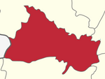
Bommidi is a panchayat town which is located in Pappireddipatti taluka of Dharmapuri district in Tamil Nadu, India. It is also known as B. Mallapuram. Bommidi's name is used for the railway station, the police station situated at Nadur, the post office, and bus transportation, while the name "B. Mallapuram" is used for schools, hospitals, and government officials. GeographyBommidi is situated 34 kilometres (21 mi) southeast of Dharmapuri. It is in the southern region of the district. Bommidi is close to the Salem district border. It is surrounded by Yercaud Hills, Kavaramalai RF and Mookanur Hills.[1] TransportBommidi has rail and bus connectivity with Chennai, Salem, Coimbatore, Mangalore, Allepy, Dhanbad, etc. RoadBommidi is situated 58 kilometres (36 mi) from the Salem bus stand, en route to Chennai via Jolarpet Junction. A number of buses run from Dharmapuri to Salem via Bommidi. Tamil Nadu State Transport Corporation (TNSTC) operates daily straight buses to Chennai, Bangalore, Trichy, Coimbatore, Palani, Madurai and very frequent bus services to Salem, Dharmapuri,Pappireddipatti Town, Omalur, and Harur. TrainsIt is connected by rail.[2] Bommidi can be reached from Salem and Dharmapuri. Bommidi Railway Station is on the Coimbatore-Chennai railway line. There is also an 11 km railway line proposal for linking Bommidi railway station lying in Salem - Jolarpettai line to Muttampatti railway station lying in Salem - Dharmapuri line. The railway station in Bommidi was built in 1861 and is one of the oldest railway stations in Tamil Nadu. Trains from Kerala to New Delhi, Chennai, and Tirupati pass through Bommidi. Bommidi has direct trains to Tirupathi, Chennai, Bangalore, Mangalore, Mumbai, Kanyakumari, and Coimbatore. AirportNearest airport: Salem Airport, is 39 KM from Bommidi, Coimbatore Airport to Bommidi 210 Km, Bangalore Airport to Bommidi 190 Km. The nearest city is Salem. TourismThere are many attraction places around the town. Aanai Maduvu Water Falls is located 9 km (5.5 miles) from bommidi. Vathalmalai Hills station, It is situated at an altitude of 1,418 m (4,652 ft) height above sea level. It is located 15 km (9.3 miles) from bommidi. It covers an area measuring nearly 225 km2 (87 sq miles). Yercaud Hills Station, It is located 39 km (24.3 miles) from bommidi in the Shevaroys range of hills in the Eastern Ghats. The total extent of Yercaud Taluk is 382.67 km2, including reserve forest. It is situated at an altitude of 1,515 metres (4,970 ft) above sea level, and the highest point in Yercaud is the Servarayan temple, at 1,623 metres (5,326 ft). Karadiyoor View Point Karadiyur View point is a natural view point situated near Karadiyur village. Karadiyoor was so named because of the large number of sloth bears found in this region earlier. This is a fantastic viewpoint with wonderful views of the valleys in Yercaud region. The mesmerizing view from the Karadiyur viewpoint is one of the prime attractions in Yercaud. The view of sunrise as well as sunset from this location is a unique attraction. Water Places near boomidi, KN Puthur Lake (5.5 km), Alapuram Lake (15 km), Vaniyaru Dam (15 km) References
External links |
||||||||||||||||||||||||||||||||||||||||||||||||||||||||

