Bluerock Mountain (North Carolina)

Bluerock Mountain
Bat Cave Mountain
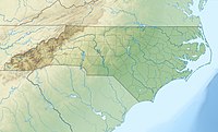
Bluerock Mountain is located in North Carolina
Bluerock Mountain
Bluerock Mountain
Location in North Carolina
Highest point
Elevation2,835 ft (864 m)[1]
Coordinates35°26′15″N 82°16′41″W / 35.43750°N 82.27806°W / 35.43750; -82.27806[1]
Geography
LocationHenderson and Rutherford counties, North Carolina, U.S.
Parent rangeBlue Ridge Mountains
Topo mapUSGS Bat Cave

Bluerock Mountain is a mountain in Western North Carolina, near the community of Bat Cave. It is split between Henderson and Rutherford counties, it is home of the Bat Cave Preserve and part of Chimney Rock State Park. Its elevation reaches 2,835 feet (864 m).

The mountain is flanked by the Broad River to its north and Reedypatch Creek[2] to its west. To its south is Rich Mountain[3] and to the east is Chimney Rock Mountain.[4] Paris Gap[5] is the gap between it and Bald Mountain,[6] it connects the community of Bat Cave and the town of Chimney Rock via Lake Lure Highway (US 64/US 74A/NC 9).

Bat Cave Reserve

The Rutherford County half is protected lands within the Chimney Rock State Park. Home of the Bat Cave, named after the several species of bats that inhabit the cave, it is protected as a reserve and not open to the public. The Bat Cave is the largest known granite fissure cave in North America.

References

  1. ^ a b "Bluerock Mountain". Geographic Names Information System. United States Geological Survey, United States Department of the Interior. Retrieved April 30, 2012.
  2. ^ "Reedypatch Creek". Geographic Names Information System. United States Geological Survey, United States Department of the Interior. Retrieved April 30, 2012.
  3. ^ "Rich Mountain". Geographic Names Information System. United States Geological Survey, United States Department of the Interior. Retrieved April 30, 2012.
  4. ^ "Chimney Rock Mountain". Geographic Names Information System. United States Geological Survey, United States Department of the Interior. Retrieved April 30, 2012.
  5. ^ "Paris Gap". Geographic Names Information System. United States Geological Survey, United States Department of the Interior. Retrieved April 30, 2012.
  6. ^ "Bald Mountain". Geographic Names Information System. United States Geological Survey, United States Department of the Interior. Retrieved April 30, 2012.