Bawan Buzurg

Bawan Buzurg
Bāwan Buzurg
Village
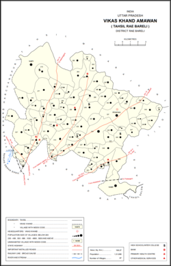
Map showing Bawan Buzurg (#271) in Amawan CD block
Bawan Buzurg is located in Uttar Pradesh
Bawan Buzurg
Bawan Buzurg
Location in Uttar Pradesh, India
Coordinates: 26°22′36″N 81°15′07″E / 26.376616°N 81.25205°E / 26.376616; 81.25205[1]
Country India India
StateUttar Pradesh
DistrictRaebareli
Area
 • Total
23.304 km2 (8.998 sq mi)
Population
 (2011)[2]
 • Total
11,754
 • Density500/km2 (1,300/sq mi)
Languages
 • OfficialHindi
Time zoneUTC+5:30 (IST)
Vehicle registrationUP-35

Bawan Buzurg Balla is a village in Amawan block of Rae Bareli district, Uttar Pradesh, India.[2] It is located near Maharajganj, south of the road to Bachhrawan and west of the road to Rae Bareli.[3] It is the largest village in the district by area.[4] As of 2011, its population is 11,754 people, in 2,154 households.[2]

History

Bawan Buzurg was historically noted for its production of shields, but this industry had ceased by the turn of the 20th century.[3] At that point, it was described as a very large and scattered village that was mostly noteworthy for its size.[3] Its population in 1901 was 4,709 people, including a Muslim minority of 540.[3] It was held in joint zamindari tenure by Pathans And Manihars claiming descent from an Afghan named Faqir Khan, who supposedly conquered the place from the Bhars in the time of Ibrahim Shah of the Jaunpur Sultanate.[3]

The 1961 census recorded Bawan Buzurg as comprising 26 hamlets, with a total population of 3,760 people (1,497 male and 2,263 female), in 978 households and 951 physical houses.[5] The area of the village was given as 6,063 acres.[5]

The 1981 census recorded Bawan Buzurg (as "Bawan Bujurg") as having a population of 6,502 people, in 707 households, and having an area of 2,330.67 hectares.[4] The main staple foods were listed as juwar and rice.[4]

References

  1. ^ "Geographic Names Search WebApp". Search for "Bawan Buzurg" here.
  2. ^ a b c d "Census of India 2011: Uttar Pradesh District Census Handbook - Rae Bareli, Part A (Village and Town Directory)" (PDF). Census 2011 India. pp. 185–201. Retrieved 4 August 2021.
  3. ^ a b c d e Nevill, H.R. (1905). Rai Bareli: A Gazetteer, Being Volume XXXIX Of The District Gazetteers Of The United Provinces Of Agra And Oudh. Allahabad: Government Press. p. 158. Retrieved 4 August 2021.
  4. ^ a b c Census 1981 Uttar Pradesh: District Census Handbook Part XIII-A: Village & Town Directory, District Rae Bareli (PDF). 1982. pp. 8, 76–7. Retrieved 10 August 2021.
  5. ^ a b Census 1961: District Census Handbook, Uttar Pradesh (39 - Raebareli District) (PDF). Lucknow. 1965. pp. xxxiv-xxxv of section "Rae Bareli Tahsil". Retrieved 4 August 2021.{{cite book}}: CS1 maint: location missing publisher (link)