|
Bagholi
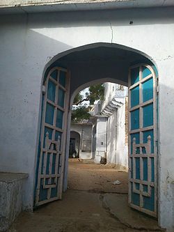
Bagholi is a village located in Neem ka thana district, Rajasthan, India. It is within a locally self-governing Scheduled Area. OverviewBagholi, located in udaipurwati tehsil (English: administrative division) and surrounded by the Aravali Range of mountains, has 8 Rajput panas,[clarification needed] each containing a separate haveli (manor). Brahmin and Baniya have individual havelis. Most local Baniya have moved to Kolkata, specifically for business in Burrabazar. The largest haveli belongs to the Thakur Sahab Phool Singh Ji, who is well known in Paintalisa.[clarification needed] He has led construction of this haveli throughout his life; it spreads around 22 bigha (approximately 35,611.4 square metres [383,318 sq ft]) centred in this village. Thakur Durg Singh Ji ruled for approximately 25 years as sarpanch (English: elected leader) of gram panchayat (English: self-governing village council), succeeded by Thakur Sahab Bhagwan Singh Ji for 5 years.[citation needed] The village has the area's first electrical grid and provides water to the villages and nearby khetri (English: copper mines).[1] See alsoReferences
|
||||||||||||||||||||

