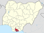
Asari-Toru

Asari-Toru
Asalga
Nickname: 
Pacesetting LGA
Motto: 
We set the pace for others to follow
Asari-Toru is located in Nigeria
Asari-Toru
Asari-Toru
Asari-Toru is located in Africa
Asari-Toru
Asari-Toru
Coordinates: 4°47′N 6°51′E / 4.783°N 6.850°E / 4.783; 6.850
CountryNigeria
StateRivers State
Date created29 May 1989
SeatBuguma City
Government
 • Local Government ChairmanEngr. Sule Amachree PhD (APP)
 • Deputy Local Government ChairmanHon. (Mrs) Tekena Daphne Wokoma (APP)
 • Local Government CouncilWard 1: Telema P. George (APP)
Ward 2: Diepriye Nifeipiri (APP)
Ward 3: Tombo M Kingmate (LP)
Ward 4: Barr Tams Georgedouglas (APP)
Ward 5: Gofabia Johnbull (APP)
Ward 6: Nyo West (APP)
Ward 7: Omuboye Braide (APP)
Ward 8: Value Ibima Harry (APP)
Ward 9: Owanate Afoma West (APP)
Ward 10: Deinpiribo Promise Igonikon(APP)
Ward 11: Martins Kombo (APP)
Ward 12:Opiribo Clinton (Actions Peoples' Party (Nigeria)
Area
 • Land44 sq mi (113 km2)
Population
 (2016)
 • Total
308,800
 • Density7,080/sq mi (2,733/km2)
 Projection
Time zoneUTC+1 (WAT)
Nigeria Postal Code
504101
Map

Asari-Toru is a Local Government Area in Rivers State, Nigeria.[1]

General information

Asari-Toru Local Government Area was created out of the old Degema Local Government Area on May 16, 1989, under the Hon. Eziwoke Wokoma. The inhabitants are of a common language which is the “Kalabari” speaking nationality. With ancestral origin and beliefs, currently, the Local Government Chairman is Hon. Dr. Sule Amachree.[2]

Asari-Toru is the “Seat” of the Ancestral Stool of the Kalabari Speaking Dynasty which cuts across Akuku-Toru and Degema Local Government Areas.[1]

Climate/Geography

There are two main seasons in Asari Toru LGA, which is 113 square kilometers in size: the dry and the rainy. The average temperature and humidity of Asari Toru LGA are 25 degrees Celsius and 91 percent, respectively. Numerous rivers and tributaries flow into Asari Toru LGA.[3]

The Local Government Area upon creation presently encompasses Seventeen (17) Communities namely:

  • Buguma,
  • Abalama,
  • Abiama,
  • Angulama,
  • Atuka,
  • Ido,
  • Ifoko,
  • Illelema,
  • Krakrama,
  • Minama,
  • Okpo,
  • Omekweama,
  • Omekwetariama,
  • Oporoama,
  • Sama,
  • Agama,
  • Tema.

Buguma City is the Headquarters of the Local Government Area and Seat of the King of Kalabari Kingdom: His Royal Majesty, King (Prof.) T.J.T Princewill, Abbi the XI, Amayanabo of Kalabari Kingdom.[4]

These communities have been grouped into thirteen (13) electoral wards, ten (10) of these wards are within the capital, Buguma City; while the remaining are grouped into Isia Group I, Isia Group II and West Central Group.[5]

The local government area has an estimated area of 113 km2 and a population of 308,800 by projection of March 21, 2016.[6]

The postal code of the area is 504101 .[7]

References

  1. ^ a b "Towns & Villages". Towns & Villages. Retrieved 2023-05-12.
  2. ^ "Full results of Rivers State local goment elections". BBC News Pidgin. Retrieved 2021-12-05.
  3. ^ "Asari-Toru Local Government Area". www.manpower.com.ng. Retrieved 2024-08-09.
  4. ^ "What ASALGA Chairman said about Amanyanabo of Kalabari Stool". KRISTINA REPORTS. 2020-08-11. Retrieved 2023-05-02.
  5. ^ Tide, The (2009-06-24). "Know Your Wards ASALGA". :::...The Tide News Online:::... Retrieved 2023-05-02.
  6. ^ Trebicka, Jonel; Schierwagen, Robert (2015-01-16). "Statins, Rho GTPases and KLF2: new mechanistic insight into liver fibrosis and portal hypertension". Gut. 64 (9): 1349–1350. doi:10.1136/gutjnl-2014-308800. ISSN 0017-5749.
  7. ^ "Post Offices- with map of LGA". NIPOST. Archived from the original on 7 October 2009. Retrieved 2009-10-20.