Census-designated place in Montana, United States
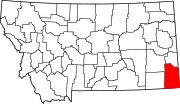
Alzada (also known as Stoneville and Telegraph Point ) is a census-designated place in southern Carter County , Montana , United States.[ 1] 2010 census it had a population of 29.[ 3] U.S. Route 212 with Montana Secondary Highways 323 and 326 , near the Wyoming and South Dakota borders. The Little Missouri River flows northwards to the west of the community. Alzada is in the Mountain Time Zone .
History
Alzada was first established in 1878, by 9th U.S. Infantry soldiers as Camp Devin , on the Deadwood, Dakota Territory to Fort Keogh , Montana Territory telegraph line. It was called the Little Missouri River Telegraph Station, and manned by soldiers of the 7th U.S. Cavalry . Then it was named Stoneville, after the local bartender Lou Stone.[ 4] Miles City, Montana . It was the site of a gun battle in 1884 between local authorities and rustlers known as the Axleby gang.[ 5] [ 6]
In 1890, Private Peter Thompson , a 7th Cavalry survivor and recipient of the Medal of Honor for the Battle of the Little Bighorn , moved from Lead, Dakota Territory , with his brother William and homesteaded north of Alzada on the Little Missouri River at Nine Mile Creek.[citation needed
Alzada was briefly in the news in September 1997, when a B-1 bomber crashed nearby.[citation needed
Climate
According to the Köppen Climate Classification system, Alzada has a semi-arid climate , abbreviated "BSk" on climate maps.[ 7]
There is a weather station located in the nearby community of Albion.[ 8] [ 9]
Climate data for Albion 1 N, Montana, 1991–2020 normals, 1945-2020 extremes: 3312ft (1009m)
Month
Jan
Feb
Mar
Apr
May
Jun
Jul
Aug
Sep
Oct
Nov
Dec
Year
Record high °F (°C)
67
73
81
91
98
106
108
107
104
95
80
69
108
Mean maximum °F (°C)
50.4
54.1
67.9
77.2
86.0
92.0
99.4
98.0
94.7
81.4
67.2
52.4
99.9
Mean daily maximum °F (°C)
28.7
31.7
42.8
53.3
64.1
74.9
84.4
83.0
72.9
55.7
42.1
30.9
55.4
Daily mean °F (°C)
16.0
18.6
28.6
38.8
49.6
59.9
67.4
65.4
54.9
40.0
27.5
17.4
40.3
Mean daily minimum °F (°C)
3.3
5.6
14.4
24.2
35.2
44.8
50.4
47.7
37.0
24.4
13.0
3.8
25.3
Mean minimum °F (°C)
−17.5
−13.6
−3.3
13.0
23.3
36.3
44.0
39.4
27.4
11.5
−4.4
−13.8
−25.7
Record low °F (°C)
−39
−37
−36
−4
8
26
33
28
12
−15
−30
−38
−39
Average precipitation inches (mm)
0.27
0.48
1.03
1.62
3.14
3.03
1.90
1.95
1.09
1.32
0.31
0.42
16.56
Average snowfall inches (cm)
2.60
7.30
5.70
3.00
1.40
0.00
0.00
0.00
0.00
1.60
3.30
3.70
28.6
Source 1: NOAA[ 10]
Source 2: XMACIS (temp records & monthly max/mins)[ 11]
Demographics
Historical population
Census Pop. Note %± 2020 25 —
See also
References
^ a b c d U.S. Geological Survey Geographic Names Information System: Alzada, Montana ^ "ArcGIS REST Services Directory" . United States Census Bureau. Retrieved September 5, 2022 .^ "Geographic Identifiers: 2010 Demographic Profile Data (G001): Alzada CDP, Montana" . U.S. Census Bureau, American Factfinder. Archived from the original on February 12, 2020. Retrieved October 8, 2014 .^ Carkeek Cheney, Roberta (1983). Names on the Face of Montana . Missoula, Montana: Mountain Press Publishing Company. p. 5. ISBN 0-87842-150-5 ^ "Valentine's Day Shootout at Stoneville" . December 16, 2009.^ Aarstad, Rich, Ellie Arguimbau, Ellen Baumler, Charlene Porsild, and Brian Shovers. "Montana Place Names from Alzada to Zortman" Archived 2009-10-08 at the Wayback Machine . Montana Historical Society Press.
^ Climate Summary for Alzada, Montana ^ "Data of Meteorological Station Albion 1 N, Montana" . geographic.org. Retrieved December 28, 2023 .
^ "Albion (in Carter County, MT) Populated Place Profile" . HomeTownLocator. Retrieved December 28, 2023 .
^
"Albion 1 N, Montana 1991-2020 Monthly Normals" . Retrieved December 28, 2023 .
^
"xmACIS" . National Oceanic and Atmospheric Administration. Retrieved December 28, 2023 .
^ "Census of Population and Housing" . Census.gov. Retrieved June 4, 2016 .
External links
Alzada, Montana at Wikimedia Commons


